Category:Maps of rivers of New Zealand
Jump to navigation
Jump to search
Media in category "Maps of rivers of New Zealand"
The following 35 files are in this category, out of 35 total.
-
 AvonRiverNZ-map.png 730 × 600; 99 KB
-
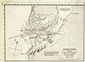 Chart of Waikato Heads, 1853 (detail) (16399595275).jpg 4,054 × 2,972; 2.3 MB
-
 DudleyCreekNZ-map.png 730 × 600; 98 KB
-
 Hope-River-Tasman.png 530 × 599; 38 KB
-
 Mangapu (rivière) OSM.png 334 × 400; 93 KB
-
 Mohaka river system.png 1,003 × 1,457; 232 KB
-
 Ngaruroro river system.png 1,003 × 1,457; 232 KB
-
 Northisland NZ Rangitikei River.png 328 × 500; 45 KB
-
 NZ-Buller R.png 1,234 × 1,395; 255 KB
-
 NZ-Clarence R.png 1,234 × 1,395; 254 KB
-
 NZ-Clutha R.png 1,234 × 1,395; 233 KB
-
 NZ-Grey R.png 1,234 × 1,395; 254 KB
-
 NZ-L Dunstan.png 617 × 697; 82 KB
-
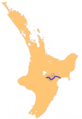
 NZ-Manawatu R.png 1,003 × 1,457; 233 KB
-
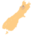
 NZ-Mataura R.png 1,234 × 1,395; 255 KB
-
 NZ-Rangitaiki R.png 1,003 × 1,457; 228 KB
-
 NZ-Rangitikei R.png 1,003 × 1,457; 231 KB
-
 NZ-Ruamahanga R.png 1,003 × 1,457; 230 KB
-
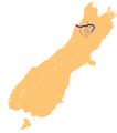
 NZ-Taieri R.png 1,234 × 1,395; 260 KB
-
 NZ-Tukituki R.png 1,003 × 1,457; 228 KB
-
 NZ-Waiau R (Canterbury).png 1,234 × 1,395; 155 KB
-
 NZ-Waiau R(south).png 1,234 × 1,395; 261 KB
-
 NZ-Waihou R.png 1,003 × 1,457; 228 KB
-
 NZ-Waikato R.png 1,003 × 1,457; 243 KB
-
 NZ-Waipa R.png 1,003 × 1,457; 240 KB
-
 NZ-Wairau R.png 1,234 × 1,395; 257 KB
-
 NZ-Wairoa R(HB).png 1,003 × 1,457; 229 KB
-
 NZ-Wairua R.png 1,003 × 1,457; 229 KB
-
 NZ-Whanganui R.png 1,003 × 1,457; 236 KB
-
 Section Index for Dudley Creek.jpg 960 × 720; 93 KB
-
 Te kooti's camp on the waipaoa river.jpg 1,106 × 1,110; 257 KB
-
 Transactions of the Royal Society of New Zealand (1881) (14778169002).jpg 1,906 × 3,146; 467 KB
-
 Tutaekuri river system.png 1,003 × 1,457; 230 KB
-
 Wairau River Map.jpg 400 × 340; 77 KB
-
 Windley (rivière) OSM.png 726 × 725; 1.01 MB

_(16399595275).jpg)


_OSM.png)


.png)
.png)


.png)


_OSM.png)
_(14778169002).jpg)