Category:Maps of rivers of Baden-Württemberg
Jump to navigation
Jump to search
Federal states of Germany:
Subcategories
This category has the following 2 subcategories, out of 2 total.
T
- Maps of the Tauber (5 F)
W
Media in category "Maps of rivers of Baden-Württemberg"
The following 26 files are in this category, out of 26 total.
-
 BaWü Flüsse.jpg 8,500 × 10,054; 5.91 MB
-
 Blinde Rot.png 372 × 537; 391 KB
-
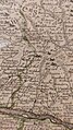
 Bodenehr schiltach.jpg 2,783 × 2,057; 1.52 MB
-
 BudS - Baden-Württemberg - Land - Stadt - Fluss.jpg 8,735 × 10,240; 16.72 MB
-
 BW Landschaften.png 825 × 951; 1.68 MB
-
 Einzugsgebiet und Flusssystem der Wiese.jpg 735 × 825; 209 KB
-
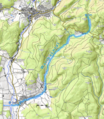
 Elsenz OSM.png 718 × 1,296; 1.52 MB
-
 Flusslauf Angenbach.png 2,000 × 1,009; 3.79 MB
-
 Flusslauf Dürrenbach.png 1,200 × 1,530; 3.02 MB
-
 Flusslauf Kander.png 2,000 × 2,072; 8.97 MB
-
 Flusslauf Kleine Wiese.png 1,126 × 2,012; 5.13 MB
-
 Flusslauf Klemmbach.png 2,000 × 1,372; 3.88 MB
-
 Flusslauf Köhlgartenwiese.png 1,000 × 2,009; 3.62 MB
-
 Flusslauf Künabach.png 2,000 × 1,046; 3.34 MB
-
 Flusslauf Prägbach.png 2,000 × 2,203; 7.95 MB
-
 Flusslauf Steinenbach (Wiese).png 1,000 × 1,500; 2.88 MB
-
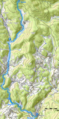
 Flusslauf Wiese.png 2,000 × 2,189; 4.02 MB
-
 Flusslauf Wollbach.png 1,500 × 1,722; 3.82 MB
-
 Karte der naturräumlichen Untereinheiten der Donau-Iller-Lech-Platte.jpg 2,691 × 2,365; 1.41 MB
-
 KLEMMBACH deFER 1710.jpg 1,152 × 2,048; 372 KB
-
 KLEMMBACH HOMANN 1718.jpg 2,048 × 1,152; 419 KB
-
 KLEMMBACH MICHAL SEUTTER 1710.jpg 1,437 × 2,048; 446 KB
-
 KLEMMBACH VISSCHER 1670.jpg 2,048 × 1,152; 435 KB
-
 LagekarteMurr.png 691 × 233; 356 KB
-
 Schwaebisches-Donaumoos Langenau Alb-Karst-Aquifer Donaukies-Aquifer.jpg 1,800 × 1,266; 809 KB
-
 Wuhre-Wehra-Alb.gif 830 × 779; 419 KB


.png)


