Category:Maps of rivers in Peru
Jump to navigation
Jump to search
Media in category "Maps of rivers in Peru"
The following 20 files are in this category, out of 20 total.
-
 Bacino Idrografico Nazca.png 1,179 × 665; 74 KB
-
 Cotacajesrivermap.jpg 1,217 × 1,429; 751 KB
-
 Cotocajesrivermap.jpg 1,217 × 1,429; 750 KB
-
 Ecuador-Peru-Frontera.svg 885 × 587; 571 KB
-
 Rio Ene.png 894 × 1,122; 2.42 MB
-
 Fitzcarrald-ishtmus istmo-fitz-carrall fitzcarraldo-path-street-crossing-peru detail.jpg 3,468 × 1,800; 1.4 MB
-
 Fitzcarrald-ishtmus istmo-fitz-carrall fitzcarraldo-path-street-crossing-peru.jpg 4,032 × 2,268; 1.74 MB
-
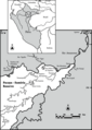 Location of the Pacaya River.png 850 × 1,191; 116 KB
-
 Mapa-novela-la-casa-verde.jpg 823 × 515; 170 KB
-
 Mapofperu.svg 1,823 × 1,223; 50 KB
-
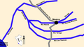
 Pijuayal-Saramiriza.png 573 × 358; 20 KB
-
 Rio Apurímac.png 872 × 970; 1.71 MB
-
 Rio Tambo.png 948 × 1,098; 2.28 MB
-
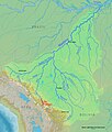
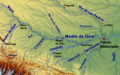 Rivers of Madre de Dios.png 1,406 × 884; 2.24 MB
-
 Río de la Paz map.png 1,500 × 1,500; 836 KB
-
 Río Tapiche OSM.png 249 × 485; 79 KB
-
 Sistema endorreico Titicaca-Desaguadero-Poopó-Salar de Coipasa.svg 1,431 × 2,953; 224 KB
-
 Sistema endorreico Titicaca-Desaguadero-Poopó-Salar de Coipasa2.svg 1,285 × 1,938; 150 KB
-
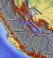
 SomosValenzuelaHESS2016-fig1-mode-en.png 4,724 × 4,159; 3.01 MB
-


_(14782171772).jpg)