Category:Maps of regions of Vojvodina
Jump to navigation
Jump to search
Subcategories
This category has the following 4 subcategories, out of 4 total.
M
S
Media in category "Maps of regions of Vojvodina"
The following 21 files are in this category, out of 21 total.
-
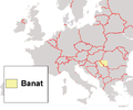
Banat in Europa.png 1,245 × 1,245; 44 KB
-
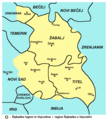
Banat location.png 507 × 422; 42 KB
-
Banaat locatie.PNG 507 × 422; 28 KB
-
Croatia-Serbia Border Map.png 2,514 × 2,548; 1.25 MB
-
Fruška Gora satellite photo.jpg 992 × 550; 167 KB
-
Northern macva03 map.png 1,324 × 1,032; 62 KB
-
Serbia022.png 1,100 × 1,606; 209 KB
-
Serbia022 02.png 1,100 × 1,464; 181 KB
-
Serbia022-sr.png 1,100 × 1,606; 207 KB
-
Srem (Sirmium).JPG 332 × 356; 25 KB
-
Syrmia hu.png 1,226 × 750; 163 KB
-
Syrmia.png 1,082 × 662; 58 KB
-
Sremregionsr.png 1,082 × 662; 53 KB
-
Срем.png 1,082 × 662; 54 KB
-
Srem-region-mapa01.png 1,566 × 931; 61 KB
-
Srem-region-mapa02.png 1,566 × 931; 115 KB
-
Srem-region-mapa03.png 1,566 × 931; 64 KB
-
Srem-region-mapa04.png 1,566 × 931; 54 KB
-
Šajkaška-hu.png 692 × 771; 53 KB
-
Šajkaška-sr.png 692 × 771; 48 KB
-
Šajkaška.png 692 × 771; 53 KB


