
Category:Maps of regions of Ecuador
Media in category "Maps of regions of Ecuador"
The following 32 files are in this category, out of 32 total.
-
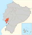 DM Gye.svg 1,536 × 1,654; 359 KB
-
 DM QUITO.svg 1,536 × 1,654; 359 KB
-
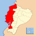
 Ecuador - R Litoral 02.svg 1,536 × 1,654; 856 KB
-
 Map coast.jpg 500 × 900; 88 KB
-
 Mapa de Ecuador.jpg 1,200 × 817; 148 KB
-
 MapaSageo-Ecuador-0R1.png 600 × 600; 31 KB
-
 MapaSageo-Ecuador-0R2.png 600 × 600; 31 KB
-
 MapaSageo-Ecuador-0R3.png 600 × 600; 31 KB
-
 R Litoral de Ecuador 001.svg 630 × 1,261; 162 KB
-
 R Litoral de Ecuador 002.svg 1,261 × 1,261; 162 KB
-
 RE GALAPAGOS.svg 1,536 × 1,654; 359 KB
-
 Region Centro EC.svg 1,536 × 1,654; 359 KB
-
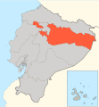 Region Centro Norte EC.svg 1,536 × 1,654; 359 KB
-
 Region Centro Sur EC.png 557 × 600; 68 KB
-
 Region Centro Transandino Ecuador.jpg 600 × 600; 60 KB
-
 Region Centro-Sur EC.svg 1,536 × 1,654; 359 KB
-
 Region Litoral EC.svg 1,536 × 1,654; 359 KB
-
 Region Norte EC.svg 1,536 × 1,654; 359 KB
-
 Region Pacifico EC.svg 1,536 × 1,654; 359 KB
-
 Region Sur EC.svg 1,536 × 1,654; 359 KB
-
 Regiones Ecuador.png 2,224 × 2,341; 199 KB
-
 Regiones Ecuador.svg 1,536 × 1,654; 452 KB
-
 Regiones Naturales del Ecuador.svg 1,535 × 1,654; 1.57 MB
-
 Regiones Naturales.svg 1,425 × 1,545; 5.02 MB
-
 REGIONESGEOGRAFICASDELECUADOR.png 661 × 385; 38 KB
-
 Región Amazónica del Ecuador.svg 1,535 × 1,654; 1.9 MB
-
 Región Amazónica.svg 1,425 × 1,545; 4.98 MB
-
 Región costa.svg 1,425 × 1,545; 5.02 MB
-
 Región Interandina del Ecuador.svg 1,535 × 1,654; 2.28 MB
-
 Región Litoral de Ecuador.svg 1,535 × 1,654; 1.19 MB
-
 Región Sierra.svg 1,425 × 1,545; 5.01 MB
-
 Zona centro Latacunga (1).jpg 800 × 861; 56 KB


.jpg)