Category:Maps of provinces of Rwanda
Jump to navigation
Jump to search
Media in category "Maps of provinces of Rwanda"
The following 26 files are in this category, out of 26 total.
-
 BugeseraMap.jpg 300 × 350; 24 KB
-
 East Province districts.png 1,056 × 816; 33 KB
-
 GatsiboMap.jpg 300 × 350; 24 KB
-
 KayonzaMap.jpg 300 × 350; 25 KB
-
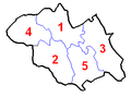
 Kigali Province districts.png 1,056 × 816; 18 KB
-
 KireheMap.jpg 300 × 350; 24 KB
-
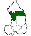
 North Province districts.png 1,056 × 816; 23 KB
-
 North province districts.png 1,056 × 816; 21 KB
-
 NyagatareMap.jpg 300 × 350; 26 KB
-
 Rwanda EastDists.png 334 × 463; 10 KB
-
 Rwanda EastProvDists.png 1,025 × 595; 18 KB
-
 Rwanda EastProvSize.png 1,025 × 595; 15 KB
-
 Rwanda KigaliDists.png 117 × 117; 2 KB
-
 Rwanda KigaliProvDists.png 1,025 × 595; 15 KB
-
 Rwanda KigaliProvSize.png 1,025 × 595; 4 KB
-
 Rwanda NorthDists.png 303 × 224; 5 KB
-
 Rwanda NorthProvDists.png 1,025 × 595; 16 KB
-
 Rwanda NorthProvSize.png 1,025 × 595; 15 KB
-
 Rwanda SouthDists.png 293 × 381; 8 KB
-
 Rwanda SouthProvDists.png 1,025 × 595; 17 KB
-
 Rwanda SouthProvSize.png 1,025 × 595; 5 KB
-
 Rwanda WestDists.png 319 × 466; 9 KB
-
 Rwanda WestProvDists.png 1,025 × 595; 17 KB
-
 Rwanda WestProvSize.png 1,025 × 595; 5 KB
-
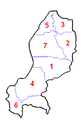
 South Province districts.png 1,056 × 816; 33 KB
-
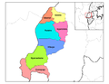 West Province districts.png 1,056 × 816; 29 KB


