Category:Maps of provinces of Papua New Guinea
Jump to navigation
Jump to search
Subcategories
This category has the following 4 subcategories, out of 4 total.
B
- Maps of Bougainville (1 P, 21 F)
M
- Maps of New Ireland Province (22 F)
W
- Maps of Western Province (13 F)
Media in category "Maps of provinces of Papua New Guinea"
The following 10 files are in this category, out of 10 total.
-
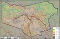
 Ehpdistricts.svg 840 × 921; 60 KB
-
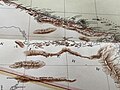
 Kartenausschnitt Astrolabe Bai und Umgebung.jpg 4,032 × 3,024; 5.46 MB
-
 Map Flag of Every Papua New Guinean Provinces.png 2,048 × 2,048; 787 KB
-
 Map of Enga Province, Papua New Guinea.pdf 1,377 × 895; 5.26 MB
-
 Muller Range Kartenausschnitt aus dem Grossen Deutschen Kolonialatlas.jpg 4,032 × 3,024; 3.74 MB
-
 Orodistricts.svg 1,433 × 1,212; 45 KB
-
 Papua New Guinea Base Map.png 1,108 × 697; 299 KB
-
 Papua new guinea provinces with capitals colour.png 1,114 × 750; 37 KB
-
 Papua new guinea provinces with capitals grey.png 1,114 × 750; 36 KB
-
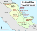
 Simbu province.jpg 1,075 × 1,282; 236 KB


