Category:Maps of protected areas of the Community of Madrid
Jump to navigation
Jump to search
Autonomous communities of Spain: Andalusia · Castile and León · Community of Madrid · Region of Murcia · Autonomous cities:
| NO WIKIDATA ID FOUND! Search for Maps of protected areas of the Community of Madrid on Wikidata | |
| Upload media |
Media in category "Maps of protected areas of the Community of Madrid"
The following 6 files are in this category, out of 6 total.
-
 Comunidad de Madrid (2020) mapa de ecoturismo en espacios naturales.png 2,825 × 3,188; 2.27 MB
-
 Espacios naturales protegidos de la Comunidad de Madrid (2011) mapa.png 1,688 × 1,551; 2.04 MB
-
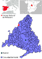 Mapa del PN Peñalara.png 283 × 396; 16 KB
-
 Mapa Parque Regional de la Cuenca Alta del Manzanares.jpg 815 × 947; 82 KB
-
 Parque regional del curso medio del Guadarrama.png 380 × 413; 52 KB
-
 Parque-sureste.JPG 284 × 303; 25 KB
_mapa_de_ecoturismo_en_espacios_naturales.png)
_mapa.png)


