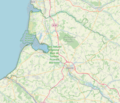
Category:Maps of protected areas in Somme
Appearance
Media in category "Maps of protected areas in Somme"
The following 4 files are in this category, out of 4 total.
-
Baie de Somme Picardie Maritime.png 677 × 579; 468 KB
-
Périmètre RNN Baie de Somme rnn118.png 1,236 × 823; 416 KB
-
Périmètre RNN Étang Saint-Ladre rnn40.png 1,239 × 827; 388 KB
-
Périmètre RNR Bois des Agneux rnr311.png 598 × 738; 249 KB


