Category:Maps of protected areas in Savoie
Jump to navigation
Jump to search
Subcategories
This category has only the following subcategory.
M
Media in category "Maps of protected areas in Savoie"
The following 7 files are in this category, out of 7 total.
-
 Périmètre RNN Bailletaz rnn150.png 1,234 × 822; 341 KB
-
 Périmètre RNN Grande Sassière rnn7.png 1,348 × 900; 796 KB
-
 Périmètre RNN Hauts de Villaroger rnn101.png 1,236 × 826; 862 KB
-
 Périmètre RNN Plan de Tuéda rnn100.png 1,237 × 824; 625 KB
-
 Périmètre RNN Tignes Champagny rnn2.png 899 × 1,058; 709 KB
-
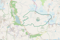
 Périmètre RNR Lac d'Aiguebelette rnr285.png 999 × 1,058; 580 KB
-
 Périmètre RNR Tourbière des Saisies - Beaufortin - Val d'Arly rnr265.png 998 × 858; 422 KB


