Category:Maps of powiat lwówecki
Jump to navigation
Jump to search
Subcategories
This category has the following 5 subcategories, out of 5 total.
G
- Maps of gmina Gryfów Śląski (2 F)
L
- Maps of gmina Lubomierz (3 F)
- Maps of gmina Lwówek Śląski (2 F)
M
- Maps of gmina Mirsk (2 F)
W
- Maps of gmina Wleń (3 F)
Media in category "Maps of powiat lwówecki"
The following 8 files are in this category, out of 8 total.
-
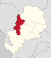 Powiat lwówecki - lokalizacja gminy Gryfów Śląski.png 1,287 × 1,451; 182 KB
-
 Powiat lwówecki - lokalizacja gminy Lubomierz.png 1,287 × 1,451; 182 KB
-
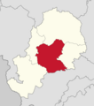
 Powiat lwówecki - lokalizacja gminy Lwówek Śląski.png 1,287 × 1,451; 182 KB
-
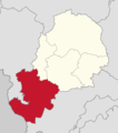 Powiat lwówecki - lokalizacja gminy Mirsk.png 1,287 × 1,451; 182 KB
-
 Powiat lwówecki - lokalizacja gminy Wleń.png 1,287 × 1,451; 182 KB
-
 Powiat lwówecki - mapa z nazwami gmin.png 1,287 × 1,451; 210 KB
-
 Powiat lwówecki - mapa.png 1,287 × 1,451; 182 KB
-
 Powiat lwówecki location map.png 1,133 × 1,331; 554 KB


