Category:Maps of polders in Utrecht (province)
Jump to navigation
Jump to search
Provinces of the Netherlands: North Holland · South Holland · Utrecht · Zeeland
Media in category "Maps of polders in Utrecht (province)"
The following 15 files are in this category, out of 15 total.
-
 Hoekwater polderkaart - Blokland polder (Mijdrecht).PNG 536 × 416; 502 KB
-
 Hoekwater polderkaart - Demmerik polder.PNG 540 × 506; 681 KB
-
 Hoekwater polderkaart - Grenzen De Proosdijlanden.PNG 800 × 845; 1.56 MB
-
 Hoekwater polderkaart - Groot en Klein Oud-Aa.PNG 583 × 393; 601 KB
-
 Hoekwater polderkaart - Groot Mijdrecht.PNG 535 × 523; 606 KB
-
 Hoekwater polderkaart - Groot-Waterschap van Woerden.PNG 836 × 600; 1.17 MB
-
 Hoekwater polderkaart - Heycop en omliggende polders.PNG 680 × 464; 775 KB
-
 Hoekwater polderkaart - Nellenstein.PNG 519 × 441; 467 KB
-
 Hoekwater polderkaart - Noorderbuurtsepolder.PNG 581 × 426; 513 KB
-
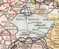 Hoekwater polderkaart - Polder Bijleveld.PNG 636 × 531; 853 KB
-
 Hoekwater polderkaart - Polder Oudenrijn.PNG 340 × 282; 241 KB
-
 Hoekwater polderkaart - Polder s Gravesloot.PNG 508 × 477; 574 KB
-
 Hoekwater polderkaart - Polder Teckop.PNG 324 × 285; 210 KB
-
 Hoekwater polderkaart - Polders bij Baambrugge.PNG 431 × 455; 501 KB
-
 Hoekwater polderkaart - Vinkeveense polder.PNG 535 × 528; 680 KB
.PNG)


