Category:Maps of old administrative divisions of Colombia
Jump to navigation
Jump to search
Subcategories
This category has the following 6 subcategories, out of 6 total.
D
O
P
Pages in category "Maps of old administrative divisions of Colombia"
The following 2 pages are in this category, out of 2 total.
Media in category "Maps of old administrative divisions of Colombia"
The following 5 files are in this category, out of 5 total.
-
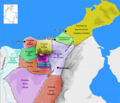
Map of the Government of Magdalena (1500).png 455 × 390; 300 KB
-
Provincia Guanebucan en la Gobernacion de Santa Marta 1500.png 455 × 390; 266 KB
-
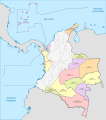
Territorios de Colombia entre 1843 y 1898.svg 2,029 × 2,296; 1.07 MB
-
Territorios de Colombia entre 1905 y 1991.svg 2,029 × 2,296; 926 KB
-
Tulenega in Panama.svg 748 × 438; 186 KB


