Category:Maps of ocean currents
Jump to navigation
Jump to search
Subcategories
This category has the following 3 subcategories, out of 3 total.
M
- Maps of the Gulf Stream (54 F)
T
Media in category "Maps of ocean currents"
The following 188 files are in this category, out of 188 total.
-
127 of '(A class book of physical geography.)' (11157797534).jpg 2,016 × 1,297; 829 KB
-
144 of 'Eclectic Physical Geography' (11200206495).jpg 1,315 × 2,066; 643 KB
-
145 of 'Eclectic Physical Geography' (11199331403).jpg 1,315 × 2,066; 915 KB
-
176 of 'The “Beaumont” Geography and Map Tracing Book' (11248550393).jpg 1,968 × 2,384; 983 KB
-
191 of 'The “Beaumont” Geography and Map Tracing Book' (11247416395).jpg 2,438 × 2,112; 1.07 MB
-
41 of 'Arnold's Geographical Handbooks' (11249182854).jpg 1,888 × 1,237; 762 KB
-
93 of 'The International Geography. ... Edited by H. R. Mill' (11170041296).jpg 680 × 1,008; 184 KB
-
A & C Black 1854 Chart of the World.jpg 3,000 × 4,977; 2.3 MB
-
Admiralty Chart No 5212 South Atlantic Ocean text.jpg 6,690 × 5,662; 3.99 MB
-
Admiralty Chart No 5212 South Atlantic Ocean, Published 1942.jpg 10,041 × 8,506; 5.18 MB
-
Admiralty Chart No 5215 North Pacific Ocean text.jpg 14,621 × 9,940; 15.75 MB
-
Admiralty Chart No 5215 North Pacific Ocean, Published 1942.jpg 14,702 × 9,940; 8.59 MB
-
Admiralty Chart No 5216 South Pacific Ocean text.jpg 6,949 × 4,135; 3.41 MB
-
Admiralty Chart No 5216 South Pacific Ocean, Published 1942.jpg 10,411 × 6,184; 4.02 MB
-
Admiralty Chart No 5310 The World General Surface Current Circulation, Published 1949.jpg 9,539 × 5,622; 13.5 MB
-
Agulhas Current NLOM .png 792 × 494; 203 KB
-
Antarctic Circumpolar Current.png 429 × 391; 242 KB
-
Antes de la formación del istmo de Panamá.png 1,054 × 708; 106 KB
-
Arctic Ocean Currents.svg 3,409 × 3,387; 752 KB
-
Atlantikströmungen 1883.jpg 2,916 × 3,893; 4.14 MB
-
Atlantiska havet, Strömmar, Nordisk familjebok.png 432 × 531; 15 KB
-
Baltic Sea circulation.svg 1,966 × 1,083; 1.34 MB
-
Bartholomew Collection map J. G.jpg 230 × 179; 33 KB
-
Bathymetry and ocean currents of the Taiwan Strait and nearby areas.png 1,205 × 1,218; 687 KB
-
Beaufort Gyre&Transpolar-Drift-Currents.jpg 1,025 × 1,024; 582 KB
-
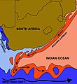
Benguela and Agulhas Currents.jpg 4,920 × 5,368; 1,020 KB
-
Black Sea Pilot 1969 Surface Current Circulation Page076.jpg 3,030 × 2,004; 2.21 MB
-
Campo de corrientes en el mar Caribe.jpg 711 × 328; 106 KB
-
Carte des courants généraux dans l Océan Atlantique by Kerhallet btv1b53148994d 1.jpg 1,024 × 1,452; 237 KB
-
Carte du sisteme des courants (...)Grenier Jacques-Raymond btv1b53105337q.jpg 1,096 × 1,054; 225 KB
-
Carte generale des principaux courants marin en 1910.jpg 859 × 571; 103 KB
-
Circulação termoalina (1).svg 1,239 × 903; 84 KB
-
Corrent Aleutianes.png 821 × 443; 80 KB
-
Corrent de Kamtxatka.png 992 × 883; 351 KB
-
Corrent de Mindanao.png 992 × 992; 1.06 MB
-
Corrents d'Alaska Califòrnia i Davidson.png 217 × 239; 20 KB
-
Corrents est d'Austràlia.jpg 586 × 545; 65 KB
-
Corrents est d'Austràlia.png 636 × 581; 42 KB
-
Corrents Madagascar.png 1,364 × 812; 160 KB
-
Corriente de Benguela-png.png 1,366 × 625; 1.45 MB
-
Corriente de Rennell.png 357 × 244; 151 KB
-
Corriente james rennell.png 1,749 × 1,913; 3.16 MB
-
Corrientes ecuatoriales del Pacífico.png 2,036 × 696; 103 KB
-
Corrientes marinas Océano Paciífico centro oriental.png 3,560 × 1,520; 84 KB
-
Corrientes peruanas.png 694 × 546; 143 KB
-
Corrientes-oceanicas-en.svg 976 × 493; 1.63 MB
-
Corrientes-oceanicas-is.svg 976 × 493; 1.67 MB
-
Corrientes-oceanicas.png 1,000 × 522; 75 KB
-
Courants atmospheriques et oceaniques.jpg 5,965 × 3,835; 3.67 MB
-
Courants exemple.png 649 × 708; 163 KB
-
Currents.svg 330 × 311; 376 KB
-
D429- N° 385. Courants du Pacifique. - liv3-ch13.png 1,456 × 1,464; 323 KB
-
Davidsonstrom.jpg 2,421 × 1,904; 311 KB
-
Deep currents of the Brazilian coast.png 667 × 545; 54 KB
-
Después de la formación del istmo de Panamá.png 1,053 × 709; 183 KB
-
Diagram of California Current System.png 864 × 1,067; 200 KB
-
Distribución de las corrientes marinas 2 rus.jpg 600 × 496; 129 KB
-
Distribución de las corrientes marinas 2.jpg 600 × 496; 55 KB
-
Driftstromen.svg 957 × 493; 2.12 MB
-
EB1911 Plankton - Atlantic surface currents.jpg 778 × 953; 346 KB
-
Elementary physical geography (1907) (14768774181).jpg 1,538 × 2,108; 791 KB
-
Elementary physical geography (1907) (14768805541).jpg 1,682 × 2,016; 839 KB
-
Elementary physical geography (1907) (14771615442).jpg 1,456 × 1,988; 753 KB
-
Elementary physical geography; (1908) (14784185302).jpg 2,480 × 1,592; 752 KB
-
Eocene-Ocean-Surface-Circulation-Kept-Earth-Warm-During-Early-Cenozoic-Time.jpg 1,486 × 724; 709 KB
-
Europe and other continents (1901) (14576899410).jpg 2,384 × 1,750; 930 KB
-
Field, laboratory, and library manual in physical geography (1906) (14596538480).jpg 2,384 × 1,450; 464 KB
-
Florida Current map.jpg 600 × 418; 40 KB
-
FMIB 36682 Courants Marins de l'Ete Boreal.jpeg 1,528 × 1,097; 491 KB
-
FMIB 36720 Courants Marins de l'Hiver Boreal.jpeg 1,528 × 1,097; 482 KB
-
FMIB 36822 Raz de Sein, Situe Entre l'Ile de Sein et la Pointe du Raz.jpeg 1,446 × 551; 223 KB
-
FMIB 43896 Oceanic Currents.jpeg 2,181 × 1,549; 1,019 KB
-
FMIB 49244 Great Ocean Currents.jpeg 701 × 439; 88 KB
-
Golf-virta.svg 934 × 690; 2.56 MB
-
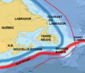
Grand Banks FR.png 799 × 683; 108 KB
-
Grand Banks.png 700 × 683; 227 KB
-
Great Pacific Garbage Patch-Map-2017.jpg 2,707 × 1,607; 657 KB
-
Guinea-Angola-Benguela.png 894 × 957; 154 KB
-
Gulf Stream Sea Surface Currents and Temperatures NASA SVS.jpg 6,840 × 2,304; 4.41 MB
-
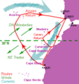
Henrican navigation routes.gif 294 × 311; 19 KB
-
Humboldt current.jpg 573 × 531; 171 KB
-
Indian Ocean Gyre.png 681 × 624; 329 KB
-
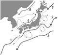
Japan's ocean currents.PNG 714 × 680; 65 KB
-
Jgrc22985-fig-0001-m.jpg 2,128 × 2,288; 910 KB
-
Kara Sea map-de.svg 507 × 470; 120 KB
-
Kuroshio geschwindigkeit.png 792 × 464; 201 KB
-
Kuroshio SST.png 792 × 464; 99 KB
-
KuroshioOyashio.jpg 590 × 410; 65 KB
-
LabradorCurrentus-coastguard-ja.jpg 432 × 540; 73 KB
-
LabradorCurrentus-coastguard.jpg 600 × 555; 146 KB
-
Leeuwin current 2.jpg 250 × 425; 30 KB
-
MAP of Angola-Benguela Front.png 3,264 × 2,448; 3.75 MB
-
Map of ocean currents (1898).jpg 2,978 × 2,180; 1.45 MB
-
Map of the Atlantic Ocean (сurrents) az.svg 331 × 473; 1.74 MB
-
Map of the Atlantic Ocean (сurrents).svg 331 × 473; 1.75 MB
-
Map of the Indian Ocean (сurrents).svg 350 × 311; 459 KB
-
Map of the Pacific region (currents).svg 730 × 543; 359 KB
-
Map of the Pacific region сurrents be.svg 730 × 543; 355 KB
-
Map WestAfrica 16cent Blake.png 4,575 × 3,313; 1.13 MB
-
Mediterranean water tracks.png 636 × 467; 84 KB
-
Mer Noire courants.jpg 2,208 × 1,510; 1.71 MB
-
Meyers b11 s0411a.jpg 2,048 × 1,577; 624 KB
-
Meyer‘s Zeitungsatlas 098 – Karte vom Großen Ocean (Mare Pacifico).jpg 7,441 × 6,258; 16.75 MB
-
MygifCurrent.gif 1,352 × 664; 23.51 MB
-
Nature (1898) (14595132277).jpg 1,806 × 1,472; 284 KB
-
North Atlantic Gyre location.png 1,200 × 784; 1.36 MB
-
North Atlantic Gyre.png 748 × 539; 379 KB
-
North Pacific Current-nl.svg 440 × 295; 289 KB
-
North Pacific Currents-Kuroshio-nl.svg 440 × 295; 276 KB
-
North Pacific Gyre World Map es.png 600 × 392; 510 KB
-
North Pacific Gyre World Map.png 1,200 × 784; 1.37 MB
-
North Pacific Gyre.png 980 × 570; 335 KB
-
North Sea Currents.svg 988 × 1,159; 453 KB
-
NorthSeaCurrents.png 1,300 × 1,700; 3.43 MB
-
Ocean circulation near New Zealand.tif 2,060 × 2,621; 4.74 MB
-
Ocean current 2004.jpg 3,148 × 2,155; 1.66 MB
-
Ocean Current and Sea Ice 3 (cropped).jpg 4,512 × 2,397; 2.11 MB
-
Ocean Current and Sea Ice 3.jpg 5,485 × 2,653; 2.43 MB
-
Ocean currents 1943 (borderless).png 2,577 × 1,306; 2.75 MB
-
Ocean currents 1943 (borderless)3.png 2,577 × 1,306; 2.41 MB
-
Ocean currents 1943 for colorblind Pacific.png 1,299 × 899; 1.06 MB
-
Ocean currents 1943 for colorblind users.png 2,577 × 1,306; 3.15 MB
-
Ocean currents 1943.jpg 2,639 × 1,406; 5.14 MB
-
Ocean currents 1943.png 2,639 × 1,406; 4.89 MB
-
Ocean currents in Panamá.jpg 640 × 417; 430 KB
-
Ocean currents, Otto's Encyclopedia.jpg 2,673 × 1,662; 1.52 MB
-
Ocean gyres currents blank.png 1,231 × 616; 754 KB
-
Ocean surface currents.jpg 927 × 480; 115 KB
-
Oceanic Currents Map.jpg 800 × 548; 136 KB
-
Oceanic gyres.png 1,875 × 1,225; 328 KB
-
Pacific oceanic gyres - South Equatorial Pacific Current.png 450 × 203; 226 KB
-
Pacific oceanic gyres.png 450 × 294; 276 KB
-
Peru current.jpg 573 × 531; 238 KB
-
Prądy morskie.svg 957 × 493; 1.78 MB
-
Rennel map 1799.png 1,318 × 1,060; 335 KB
-
Schematic map North brazil Current retroflection and rings.png 1,280 × 720; 105 KB
-
South Atlantic Gyre.png 674 × 534; 170 KB
-
South Pacific Gyre.png 1,002 × 520; 454 KB
-
Techeniya Tihogo okeana.svg 330 × 311; 297 KB
-
Thermometrical navigation Fleuron W007573-7.png 1,244 × 1,360; 64 KB
-
Tiefseegräben Karte.png 1,500 × 762; 1.19 MB
-
United States Exploring Expedition BHL32614256.jpg 4,834 × 3,532; 2.02 MB
-
VoltaDoMar.jpg 1,600 × 1,600; 287 KB
-
World Ocean Current Chart - August.jpg 8,426 × 5,091; 10.53 MB
-
World Ocean Current Chart - February.jpg 8,403 × 5,120; 10.08 MB
-
World Ocean Current.ja.jpg 5,000 × 2,500; 835 KB
-
Поширення синього кита.jpg 600 × 350; 88 KB


