Category:Maps of neighborhoods in Tehran
Jump to navigation
Jump to search
Most populous urban areas of the world: Boston [US] · Istanbul [TR] · Los Angeles [US] · Osaka [JP] · Tehran [IR] · Tokyo [JP] · Washington, D.C. [US]
- Iranian provincial capitals
- Tehran
- Cities in Tehran Province
- Tehran
Media in category "Maps of neighborhoods in Tehran"
The following 24 files are in this category, out of 24 total.
-
 Africa Boulevard in Tehran map (in black).GIF 934 × 787; 220 KB
-
 Elahiye in Tehran.PNG 991 × 570; 60 KB
-
 Esteghlal blvd in east tehran.jpg 1,291 × 649; 520 KB
-
 Farahzad in Tehran.PNG 991 × 570; 61 KB
-
 Farmaniyeh in Tehran.PNG 991 × 570; 60 KB
-
 Gisha in Tehran map (in black).JPG 934 × 787; 109 KB
-
 Guisha in Tehran.PNG 991 × 570; 61 KB
-
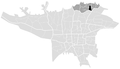
 Milad Tower location in Tehran.JPG 624 × 522; 51 KB
-
 Narmak in Tehran map (Black).JPG 707 × 455; 55 KB
-
 Poonak in Tehran map.JPG 707 × 455; 55 KB
-
 Rey in Tehran map (black).JPG 707 × 455; 54 KB
-
 Rey, Iran map.JPG 577 × 392; 35 KB
-
 Sa'adat Abad in Tehran map (in black).JPG 934 × 787; 109 KB
-
 Shahrak-e Gharb in Tehran map new (black).JPG 667 × 423; 49 KB
-

-
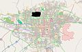
 Tehran Map openstreetmap (Niroo Havaei).png 859 × 599; 621 KB
-
 Tehran Map openstreetmap (Yousef Abad - Tehran).png 896 × 582; 369 KB
-
 Tehran Map openstreetmap.png 906 × 664; 714 KB
-
 Tehran Province Blank.png 872 × 439; 18 KB
-
 TehranBlank.PNG 991 × 570; 69 KB
-
 Tehranno in map of Tehran (in black).GIF 934 × 787; 220 KB
-
 Tehranpars in Tehran map.JPG 707 × 455; 55 KB
-
 University of Tehran in Tehran map (in black).GIF 934 × 787; 220 KB
-
 نقشه مجتمع مسکونی سپه شهر.png 1,902 × 1,249; 541 KB
.GIF)


.JPG)


.JPG)

.JPG)

.JPG)
.JPG)
.JPG)
.png)
.png)

.GIF)

.GIF)
