Category:Maps of neighborhoods in Kagoshima
Jump to navigation
Jump to search
English: Category about maps of neighbourhoods in Kagoshima city, Kagoshima prefecture, Japan.
Media in category "Maps of neighborhoods in Kagoshima"
The following 15 files are in this category, out of 15 total.
-
 Dairyu-Cho old-area Map.png 500 × 672; 231 KB
-
 Izumi-Cho old-area Map.png 972 × 680; 563 KB
-
 Kagoshima Hamamachi area map.png 659 × 527; 386 KB
-
 Kagoshima Usuki Chome map 2021.png 821 × 652; 862 KB
-
 Kagoshima-ogawa-cho-old-area-map.png 1,079 × 650; 759 KB
-
 Kagoshima-shinmachi-old-areamap.png 737 × 623; 267 KB
-
 Kagoshima-yamashita-cho-old-area-map.png 669 × 564; 553 KB
-
 Kamihonmachi old-area Map.png 1,031 × 543; 350 KB
-
 Map of Kajiyacho, Kagoshima.png 794 × 624; 432 KB
-
 Meizan-Cho old-area Map.png 906 × 608; 505 KB
-
 Taniyamashioya-cho map.png 370 × 521; 24 KB
-
 Taniyamashioyacho 2013.svg 744 × 1,052; 89 KB
-
 Tenokuchi-cho-old-areamap.png 730 × 485; 352 KB
-
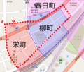 Yanagimachi old-area Map.png 479 × 409; 184 KB
-
 Yasui-Cho old-area Map.png 533 × 481; 356 KB


