Category:Maps of national parks of the Netherlands
Jump to navigation
Jump to search
Subcategories
This category has the following 4 subcategories, out of 4 total.
Media in category "Maps of national parks of the Netherlands"
The following 23 files are in this category, out of 23 total.
-
 NL-Nationaleparken.svg 220 × 250; 184 KB
-
 Man of War Shoal Map.jpg 970 × 676; 62 KB
-
 NP Arikok Map.jpg 948 × 877; 103 KB
-
 NP Nieuw Land Map.jpg 741 × 630; 58 KB
-
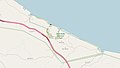 NP Shete Boka Map.jpg 1,015 × 576; 49 KB
-
 NP-DeAldeFeanenKaart.jpg 750 × 679; 102 KB
-
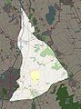
 NP-DeGrootePeelKaart.jpg 1,082 × 879; 288 KB
-
 NP-DeLoonseEnDrunenseDuinenKaart.jpg 1,129 × 757; 411 KB
-
 NP-DeMaasduinenKaart.jpg 854 × 952; 342 KB
-
 NP-DeZoom-KalmthoutseHeideKaart.jpg 895 × 785; 332 KB
-
 NP-DrentscheAaKaart.jpg 723 × 977; 248 KB
-
 NP-DrentsFrieseWoldKaart.jpg 601 × 568; 120 KB
-
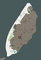 NP-DunesTexelKaart.jpg 743 × 1,086; 133 KB
-
 NP-DwingelderveldKaart.jpg 513 × 432; 81 KB
-
 NP-HogeVeluweKaart.jpg 474 × 572; 109 KB
-
 NP-MeinwegKaart.jpg 1,078 × 667; 963 KB
-
 NP-OosterscheldeKaart.jpg 981 × 781; 245 KB
-
 NP-SallandseHeuvelrugKaart.jpg 374 × 496; 67 KB
-
 NP-SchiermonnikoogKaart.jpg 857 × 497; 41 KB
-
 NP-UtrechtseHeuvelrugKaart.jpg 991 × 639; 289 KB
-
 NP-WeerribbenWiedenKaart.jpg 843 × 881; 224 KB
-
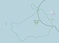 Saba Bank NP Map.jpg 697 × 514; 21 KB
-
 Washington-Slaagbai Map.jpg 983 × 735; 55 KB


