Category:Maps of national parks
Jump to navigation
Jump to search
Subcategories
This category has the following 2 subcategories, out of 2 total.
Media in category "Maps of national parks"
The following 52 files are in this category, out of 52 total.
-
 Altos de Nsork National Park, Equatorial Guinea (boundaries).png 562 × 403; 216 KB
-
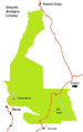 Braulio Carrillo map.png 259 × 411; 92 KB
-
 Cairngorms National Park UK location map.svg 1,425 × 1,173; 1.35 MB
-
 Cairngorms National Park UK relief location map.png 2,001 × 1,646; 3.98 MB
-
 Chitwan-NP+bufferzone-map.jpg 945 × 510; 278 KB
-
 CongoforestbasinTRIDOM.jpg 661 × 669; 214 KB
-
 Curacao.JPG 1,847 × 1,335; 762 KB
-
 Dinaric Alps National Parks map-fr.svg 1,857 × 1,503; 3.49 MB
-
 EC Cotopaxi Nationalpark 2012.jpg 1,605 × 1,203; 859 KB
-
 French Island National Park.png 871 × 639; 92 KB
-
 G-National park-names-ar.svg 300 × 500; 15 KB
-
 G-National park-names.svg 300 × 500; 12 KB
-
 HambergSarekKarta1922.jpg 2,000 × 2,429; 966 KB
-
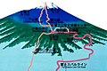
 Japón, Fuji (2005) 01.jpg 1,044 × 726; 796 KB
-
 Japón, Fuji (2005) 02.jpg 1,071 × 713; 567 KB
-
 Karte Nationalpark Kalkalpen.png 2,849 × 2,184; 462 KB
-
 Kgalagadi Transfrontier Park map.gif 329 × 352; 14 KB
-
 Lahemaa location map.svg 1,668 × 1,112; 438 KB
-
 Localización de Yasuní en Ecuador.svg 1,538 × 1,655; 540 KB
-
 Loch Lomond and The Trossachs National Park UK location map.svg 1,425 × 1,247; 1.31 MB
-
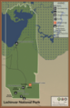 Lochinvar National Park.png 3,300 × 5,100; 2.87 MB
-
 LocMap Bardia.png 280 × 160; 13 KB
-
 LocMap Khaptad.png 280 × 160; 13 KB
-
 LocMap Shivapuri.png 280 × 160; 13 KB
-
 Map At Black River (4824037728).jpg 1,600 × 1,200; 410 KB
-
 Map at Pétrin (4823880872).jpg 1,600 × 1,200; 335 KB
-
 Map of national parks based on location.jpg 1,663 × 927; 325 KB
-
 Map of Yambaru National Park.svg 750 × 1,000; 434 KB
-
 Model of Szalajka Valley and its area, Szilvásvárad, 2016 Hungary.jpg 2,272 × 1,704; 969 KB
-
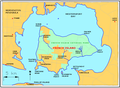
 National Park system of Gabon.jpg 768 × 769; 312 KB
-
 National Parks of Europe (April 2013).svg 680 × 520; 1.39 MB
-
 National parks of Russa 2010.jpg 1,335 × 803; 91 KB
-
 Nitmiluk National Park 0317.svg 743 × 845; 100 KB
-
 Northeast Greenland National Park in Greenland 2018.svg 1,181 × 1,669; 846 KB
-
 Northeast Greenland National Park in Greenland.svg 1,181 × 1,669; 1.15 MB
-
 O Le Pupu Pu'e National Park.png 430 × 225; 71 KB
-
 Parque Nacional Predelta.svg 507 × 708; 127 KB
-
 Parque nacional Torres de Paine.svg 1,091 × 1,427; 241 KB
-
 Peta Kawasan Taman Nasional Gunung Halimun-Salak.png 842 × 595; 626 KB
-
 Peta Zonasi Taman Nasional Berbak.jpg 1,280 × 1,081; 217 KB
-
 PL Tatra Montains National Park.svg 1,844 × 1,219; 70 KB
-
 RussianNationalParksmap.jpg 1,386 × 774; 87 KB
-
 Sangha Tri National Landscape-HE.jpg 647 × 830; 143 KB
-
 Slovenský ráj - mapa.svg 1,300 × 700; 48 KB
-
 The map of Sochut dendropark.jpg 3,840 × 2,160; 2.92 MB
-
 Toubkal National Park map.svg 1,223 × 995; 238 KB
-
 Tunisie - Parcs nationaux et réserves naturelles.jpg 2,760 × 3,941; 6.4 MB
-
 Tájékoztató emberi nyelven - panoramio.jpg 2,101 × 1,524; 770 KB
-
 Uganda QENP map.svg 1,441 × 1,466; 361 KB
-
 Zonasi taman nasional kerinci seblat 2017.jpg 877 × 616; 253 KB
-
 Ördög-orom Quarry Conservation Area. East entry. - Budapest.JPG 1,659 × 1,244; 570 KB
-
 Übersichtskarte Nationalpark Kalkalpen.jpg 2,480 × 1,781; 3.04 MB
.png)


_01.jpg)
_02.jpg)


.jpg)
.jpg)


.svg)


