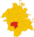
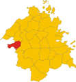
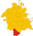
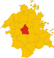
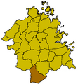
Category:Maps of municipalities of the province of Olbia-Tempio
Jump to navigation
Jump to search
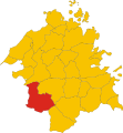
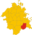
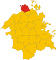
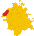
English: Maps of municipalities of the province of Olbia-Tempio until 2016, region Sardinia, Italy
Italiano: Mappe dei comuni della provincia di Olbia-Tempio sino al 2016, regione Sardegna, Italia
Media in category "Maps of municipalities of the province of Olbia-Tempio"
The following 50 files are in this category, out of 50 total.
-
Map of comune of Aglientu (province of Olbia-Tempio, region Sardinia, Italy).svg 5,037 × 5,463; 88 KB
-
Map of comune of Arzachena (province of Olbia-Tempio, region Sardinia, Italy).svg 5,037 × 5,463; 88 KB
-
Map of comune of Badesi (province of Olbia-Tempio, region Sardinia, Italy).svg 5,037 × 5,463; 88 KB
-
Map of comune of Berchidda (province of Olbia-Tempio, region Sardinia, Italy).svg 5,037 × 5,463; 88 KB
-
Map of comune of Bortigiadas (province of Olbia-Tempio, region Sardinia, Italy).svg 5,037 × 5,463; 88 KB
-
Map of comune of Buddusò (province of Olbia-Tempio, region Sardinia, Italy).svg 5,037 × 5,463; 88 KB
-
Map of comune of Budoni (province of Olbia-Tempio, region Sardinia, Italy).svg 5,037 × 5,463; 88 KB
-
Map of comune of Calangianus (province of Olbia-Tempio, region Sardinia, Italy).svg 5,037 × 5,463; 88 KB
-
Map of comune of Golfo Aranci (province of Olbia-Tempio, region Sardinia, Italy).svg 5,037 × 5,463; 88 KB
-
Map of comune of La Maddalena (province of Olbia-Tempio, region Sardinia, Italy).svg 5,037 × 5,463; 88 KB
-
Map of comune of Luogosanto (province of Olbia-Tempio, region Sardinia, Italy).svg 5,037 × 5,463; 88 KB
-
Map of comune of Luras (province of Olbia-Tempio, region Sardinia, Italy).svg 5,037 × 5,463; 88 KB
-
Map of comune of Monti (province of Olbia-Tempio, region Sardinia, Italy).svg 5,037 × 5,463; 88 KB
-
Map of comune of Olbia (province of Olbia-Tempio, region Sardinia, Italy).svg 5,037 × 5,463; 88 KB
-
Map of comune of Oschiri (province of Olbia-Tempio, region Sardinia, Italy).svg 5,037 × 5,463; 88 KB
-
Map of comune of Padru (province of Olbia-Tempio, region Sardinia, Italy).svg 5,037 × 5,463; 88 KB
-
Map of comune of Palau (province of Olbia-Tempio, region Sardinia, Italy).svg 5,037 × 5,463; 88 KB
-
Map of comune of San Teodoro (province of Olbia-Tempio, region Sardinia, Italy).svg 5,037 × 5,463; 88 KB
-
Map of comune of Telti (province of Olbia-Tempio, region Sardinia, Italy).svg 5,037 × 5,463; 88 KB
-
AggiusLocatie.png 428 × 462; 16 KB
-
AglientuLocatie.png 428 × 462; 16 KB
-
Alà Dei SardiLocatie.png 428 × 462; 16 KB
-
ArzachenaLocatie.png 428 × 462; 16 KB
-
BadesiLocatie.png 428 × 462; 16 KB
-
BerchiddaLocatie.png 428 × 462; 16 KB
-
BortigiadasLocatie.png 428 × 462; 16 KB
-
BuddusoLocatie.png 428 × 462; 16 KB
-
CalangianusLocatie.png 428 × 462; 16 KB
-
Golfo AranciLocatie.png 428 × 462; 16 KB
-
La MaddalenaLocatie.png 428 × 462; 16 KB
-
Loiri Porto San PaoloLocatie.png 428 × 462; 16 KB
-
LuogosantoLocatie.png 428 × 462; 16 KB
-
LurasLocatie.png 428 × 462; 16 KB
-
MontiLocatie.png 428 × 462; 16 KB
-
OlbiaLocatie.png 428 × 462; 16 KB
-
OschiriLocatie.png 428 × 462; 16 KB
-
PadruLocatie.png 428 × 462; 16 KB
-
PalauOTLocatie.png 428 × 462; 16 KB
-
San TeodoroOTLocatie.png 428 × 462; 16 KB
-
Santa Teresa di GalluraLocatie.png 428 × 462; 16 KB
-
SantAntonio di GalluraLocatie.png 428 × 462; 16 KB
-
TeltiLocatie.png 428 × 462; 16 KB
-
Tempio PausaniaLocatie.png 428 × 462; 16 KB
-
Trinita DAgultu E VignolaLocatie.png 428 × 462; 16 KB


