Category:Maps of municipalities of Switzerland to 1993
Jump to navigation
Jump to search
Media in category "Maps of municipalities of Switzerland to 1993"
The following 15 files are in this category, out of 15 total.
-
 Karte Bezirke der Schweiz farbig 1992.png 4,133 × 2,848; 3.06 MB
-
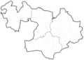 Karte Gemeinden des Kantons Basel-Landschaft 1972.png 2,952 × 2,137; 1.05 MB
-
 Karte Gemeinden des Kantons Basel-Landschaft farbig 1972.png 2,952 × 2,137; 1.3 MB
-
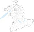 Karte Gemeinden des Kantons Bern 1993.png 2,952 × 2,740; 1.81 MB
-
 Karte Gemeinden des Kantons Bern farbig 1993.png 2,952 × 2,740; 2.19 MB
-
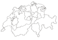 Karte Kantone der Schweiz 1979 ohne Seen.png 4,133 × 2,848; 1.15 MB
-
 Karte Kantone der Schweiz 1979.png 4,133 × 2,848; 1.95 MB
-
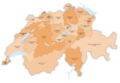 Karte Kantone der Schweiz farbig 1979.png 4,133 × 2,848; 2.04 MB
-
 Karte Gemeinden des Kantons Solothurn 1993.png 2,952 × 2,703; 1.68 MB
-
 Karte Gemeinden des Kantons Solothurn farbig 1993.png 2,952 × 2,703; 2.02 MB
-
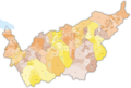
 Karte Gemeinden des Kantons St. Gallen farbig 1965.png 2,952 × 3,400; 1.5 MB
-
 Karte Gemeinden des Kantons Thurgau 1993.png 2,952 × 1,786; 824 KB
-
 Karte Gemeinden des Kantons Thurgau farbig 1993.png 2,952 × 1,786; 1.08 MB
-
 Karte Gemeinden des Kantons Wallis 1972.png 3,836 × 2,598; 1.75 MB
-
 Karte Gemeinden des Kantons Wallis farbig 1987.png 3,836 × 2,598; 1.98 MB


