Category:Maps of municipalities of Switzerland to 1983
Jump to navigation
Jump to search
Media in category "Maps of municipalities of Switzerland to 1983"
The following 12 files are in this category, out of 12 total.
-
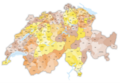
 Karte Bezirke und Kreise der Schweiz farbig 1979.png 4,133 × 2,848; 3.3 MB
-
 Karte Bezirke der Schweiz farbig 1979.png 4,133 × 2,848; 2.96 MB
-
 Karte Gemeinden des Kantons Aargau farbig 1983.png 2,952 × 2,820; 2.28 MB
-
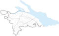
 Karte Gemeinden des Kantons Genf farbig 1952.png 1,476 × 1,363; 517 KB
-
 Karte Gemeinden des Kantons Graubünden farbig 1983.png 3,836 × 2,751; 2.43 MB
-
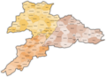
 Karte Gemeinden des Kantons Bern farbig 1975.png 2,952 × 2,821; 2.44 MB
-
 Karte Gemeinden des Kantons Jura 1979.png 2,952 × 2,151; 1.03 MB
-
 Karte Gemeinden des Kantons Jura farbig 1979.png 2,952 × 2,151; 1.25 MB
-
 Karte Gemeinden des Kantons Thurgau 1979-2.png 2,952 × 1,786; 825 KB
-
 Karte Gemeinden des Kantons Thurgau 1983.png 2,952 × 1,786; 825 KB
-
 Karte Gemeinden des Kantons Thurgau farbig 1979-2.png 2,952 × 1,786; 1.09 MB
-
 Karte Gemeinden des Kantons Thurgau farbig 1983.png 2,952 × 1,786; 1.09 MB


