Category:Maps of municipalities of Switzerland to 1865
Jump to navigation
Jump to search
Media in category "Maps of municipalities of Switzerland to 1865"
The following 10 files are in this category, out of 10 total.
-
 Karte Bezirke und Kreise der Schweiz 1862.png 4,133 × 2,848; 2.62 MB
-
 Karte Bezirke und Kreise der Schweiz farbig 1862.png 4,133 × 2,848; 3.25 MB
-
 Karte Bezirke der Schweiz 1862.png 4,133 × 2,848; 2.46 MB
-
 Karte Bezirke der Schweiz farbig 1862.png 4,133 × 2,848; 2.92 MB
-
 Karte Gemeinden des Kantons Aargau 1854.png 2,952 × 2,820; 1.73 MB
-
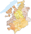
 Karte Gemeinden des Kantons Aargau farbig 1854.png 2,952 × 2,820; 2.32 MB
-
 Karte Gemeinden des Kantons Freiburg 1860.png 1,476 × 1,643; 776 KB
-
 Karte Gemeinden des Kantons Freiburg farbig 1860.png 2,952 × 3,285; 2.75 MB
-
 Karte Gemeinden des Kantons Wallis 1850.png 3,837 × 2,599; 1.71 MB
-
 Karte Gemeinden des Kantons Wallis farbig 1850.png 3,838 × 2,600; 1.97 MB


