Category:Maps of municipalities of Switzerland to 1852
Jump to navigation
Jump to search
Media in category "Maps of municipalities of Switzerland to 1852"
The following 8 files are in this category, out of 8 total.
-
 Karte Gemeinden des Kantons Aargau 1850.png 2,952 × 2,820; 1.7 MB
-
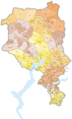
 Karte Gemeinden des Kantons Aargau farbig 1850.png 2,952 × 2,820; 2.32 MB
-
 Karte Gemeinden des Kantons Bern 1852.png 2,952 × 2,811; 1.97 MB
-
 Karte Gemeinden des Kantons Bern farbig 1852.png 2,952 × 2,811; 2.45 MB
-
 Karte Gemeinden des Kantons Luzern 1850.png 2,951 × 2,972; 1.41 MB
-
 Karte Gemeinden des Kantons Luzern farbig 1850.png 2,951 × 2,972; 1.65 MB
-
 Karte Gemeinden des Kantons Tessin 1852.png 1,476 × 2,439; 920 KB
-
 Karte Gemeinden des Kantons Tessin farbig 1852.png 1,771 × 2,926; 1.49 MB


