Category:Maps of municipalities of Japan
Jump to navigation
Jump to search
日本語: 日本の基礎自治体(市町村・特別区)の地図。
Subcategories
This category has the following 7 subcategories, out of 7 total.
C
F
L
M
T
Media in category "Maps of municipalities of Japan"
The following 18 files are in this category, out of 18 total.
-
 Japan admin levels.svg 512 × 264; 2.79 MB
-
 Japan districts.png 908 × 1,025; 61 KB
-
 Japan Municipal Map.png 8,192 × 8,192; 2.23 MB
-
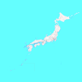 Japan Municipality Map.png 5,310 × 5,310; 301 KB
-
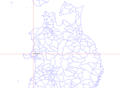
 JpLargeMap Hokuriku.png 1,260 × 919; 52 KB
-
 JpLargeMap IoIsland.png 1,260 × 919; 3 KB
-
 JpLargeMap IzuIslands.png 630 × 919; 5 KB
-
 JpLargeMap KantoTokai.png 1,260 × 919; 43 KB
-
 JpLargeMap Kinki.png 1,260 × 888; 52 KB
-
 JpLargeMap OgasawaraIslands.png 1,260 × 919; 3 KB
-
 JpLargeMap Okinawa-A.png 1,260 × 889; 10 KB
-
 JpLargeMap Okinawa-B.png 1,260 × 919; 6 KB
-
 JpLargeMap Okinawa-C.png 1,260 × 919; 5 KB
-
 JpLargeMap Shikoku.png 1,260 × 888; 49 KB
-
 JpLargeMap Tohoku-A.png 1,260 × 919; 29 KB
-
 JpLargeMap Tohoku-B.png 1,260 × 919; 41 KB
-
 Map of prefectures with municipalities Ja.png 4,396 × 3,635; 213 KB
-
 Seto Inland Sea Map.png 1,750 × 888; 82 KB


