Category:Maps of municipalities of Havana
Jump to navigation
Jump to search
Media in category "Maps of municipalities of Havana"
The following 22 files are in this category, out of 22 total.
-
 Mapa Habana.png 1,444 × 912; 172 KB
-
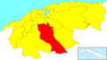 Havana Map - Arroyo Naranjo.png 1,298 × 722; 107 KB
-
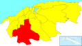 Havana Map - Boyeros.png 1,298 × 722; 107 KB
-
 Havana Map - Centro Habana.png 1,298 × 722; 107 KB
-
 Havana Map - Cerro.png 1,298 × 722; 107 KB
-
 Havana Map - Cotorro.png 1,298 × 722; 107 KB
-
 Havana Map - Diez de Octubre.png 1,298 × 722; 107 KB
-
 Havana Map - Guanabacoa.png 1,298 × 722; 107 KB
-
 Havana Map - Habana del Este.png 1,298 × 722; 107 KB
-
 Havana Map - Habana Vieja.png 1,298 × 722; 107 KB
-
 Havana Map - La Lisa.png 1,298 × 722; 107 KB
-
 Havana Map - Marianao.png 1,298 × 722; 107 KB
-
 Havana Map - Playa.png 1,298 × 722; 107 KB
-
 Havana Map - Plaza de la Revolución.png 1,298 × 722; 107 KB
-
 Havana Map - Regla.png 1,298 × 722; 107 KB
-
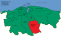
 Havana Map - San Miguel del Padrón.png 1,298 × 722; 107 KB
-
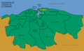
 Ciudad de La Habana municipalities.jpg 512 × 358; 20 KB
-
 Havana Districts Map (2022).svg 512 × 330; 6.01 MB
-
 Map of Havana showing Central Train Station.png 1,200 × 732; 140 KB
-
 Mapacotorro.png 800 × 488; 102 KB
-
 Regla (Havana) - District Map.png 681 × 551; 39 KB
-
 San Ant De Los Banos - DPLA - 40aa0abc4c5e12d1cbaec4e661fabf55.jpg 7,596 × 6,872; 3.34 MB


.svg)


_-_District_Map.png)
