Category:Maps of municipalities in the district of Wasseramt old
Jump to navigation
Jump to search
Media in category "Maps of municipalities in the district of Wasseramt old"
The following 21 files are in this category, out of 21 total.
-
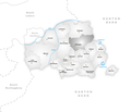
 Karte Gemeinde Aeschi SO.png 1,062 × 909; 198 KB
-
 Karte Gemeinde Biberist.png 1,062 × 909; 199 KB
-
 Karte Gemeinde Bolken.png 1,062 × 909; 197 KB
-
 Karte Gemeinde Deitingen.png 1,062 × 909; 199 KB
-
 Karte Gemeinde Derendingen.png 1,062 × 909; 198 KB
-
 Karte Gemeinde Etziken.png 1,062 × 909; 197 KB
-
 Karte Gemeinde Gerlafingen.png 1,062 × 909; 196 KB
-
 Karte Gemeinde Halten.png 1,062 × 909; 196 KB
-
 Karte Gemeinde Heinrichswil-Winistorf.png 1,062 × 909; 197 KB
-
 Karte Gemeinde Hersiwil.png 1,062 × 909; 196 KB
-
 Karte Gemeinde Horriwil.png 1,062 × 909; 197 KB
-
 Karte Gemeinde Hüniken.png 1,062 × 909; 195 KB
-
 Karte Gemeinde Kriegstetten.png 1,062 × 909; 196 KB
-
 Karte Gemeinde Lohn-Ammannsegg.png 1,062 × 909; 198 KB
-
 Karte Gemeinde Luterbach.png 1,062 × 909; 199 KB
-
 Karte Gemeinde Obergerlafingen.png 1,062 × 909; 196 KB
-
 Karte Gemeinde Oekingen.png 1,062 × 909; 196 KB
-
 Karte Gemeinde Recherswil.png 1,062 × 909; 198 KB
-
 Karte Gemeinde Steinhof.png 1,062 × 909; 196 KB
-
 Karte Gemeinde Subingen.png 1,062 × 909; 198 KB
-
 Karte Gemeinde Zuchwil.png 1,062 × 909; 198 KB


