Category:Maps of municipalities in the district of Waldenburg
Jump to navigation
Jump to search
Subcategories
This category has only the following subcategory.
Media in category "Maps of municipalities in the district of Waldenburg"
The following 16 files are in this category, out of 16 total.
-
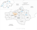
 Karte Gemeinden des Bezirks Waldenburg 2007.png 1,476 × 1,233; 397 KB
-
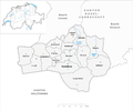
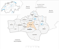
 Karte Gemeinde Arboldswil 2007.png 1,476 × 1,233; 398 KB
-
 Karte Gemeinde Bennwil 2007.png 1,476 × 1,233; 399 KB
-
 Karte Gemeinde Bretzwil 2007.png 1,476 × 1,233; 399 KB
-
 Karte Gemeinde Diegten 2007.png 1,476 × 1,233; 399 KB
-
 Karte Gemeinde Eptingen 2007.png 1,476 × 1,233; 399 KB
-
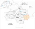
 Karte Gemeinde Hölstein 2007.png 1,476 × 1,233; 399 KB
-
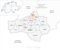 Karte Gemeinde Lampenberg 2007.png 1,476 × 1,233; 398 KB
-
 Karte Gemeinde Langenbruck 2007.png 1,476 × 1,233; 398 KB
-
 Karte Gemeinde Lauwil 2007.png 1,476 × 1,233; 399 KB
-
 Karte Gemeinde Liedertswil 2007.png 1,476 × 1,233; 398 KB
-
 Karte Gemeinde Niederdorf 2007.png 1,476 × 1,233; 399 KB
-
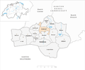
 Karte Gemeinde Oberdorf 2007.png 1,476 × 1,233; 399 KB
-
 Karte Gemeinde Reigoldswil 2007.png 1,476 × 1,233; 399 KB
-
 Karte Gemeinde Titterten 2007.png 1,476 × 1,233; 398 KB
-
 Karte Gemeinde Waldenburg 2007.png 1,476 × 1,233; 399 KB


