Category:Maps of municipalities in the district of Oberklettgau to 2012
Jump to navigation
Jump to search
Media in category "Maps of municipalities in the district of Oberklettgau to 2012"
The following 9 files are in this category, out of 9 total.
-
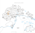
 Gemeinden des Bezirk Oberklettgau 2010.png 1,476 × 1,394; 388 KB
-
 Karte Gemeinde Guntmadingen 2009.png 1,476 × 1,378; 571 KB
-
 Karte Gemeinde Guntmadingen 2010.png 1,476 × 1,394; 389 KB
-
 Karte Gemeinde Gächlingen 2009.png 1,476 × 1,378; 572 KB
-
 Karte Gemeinde Gächlingen 2010.png 1,476 × 1,394; 389 KB
-
 Karte Gemeinde Löhningen 2009.png 1,476 × 1,378; 572 KB
-
 Karte Gemeinde Löhningen 2010.png 1,476 × 1,394; 389 KB
-
 Karte Gemeinde Neunkirch 2009.png 1,476 × 1,378; 572 KB
-
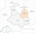
 Karte Gemeinde Neunkirch 2010.png 1,476 × 1,394; 390 KB


