Category:Maps of municipalities in the district of Oberaargau to 2020
Jump to navigation
Jump to search
Media in category "Maps of municipalities in the district of Oberaargau to 2020"
The following 46 files are in this category, out of 46 total.
-
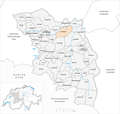
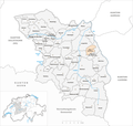
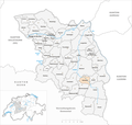
 Karte Gemeinden des Verwaltungskreis Oberaargau 2020.png 1,476 × 1,402; 520 KB
-
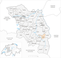
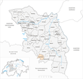
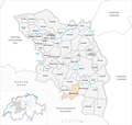
 Karte Gemeinde Aarwangen 2020.png 1,476 × 1,402; 520 KB
-
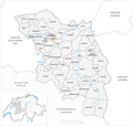
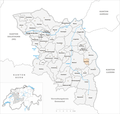
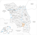
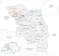
 Karte Gemeinde Attiswil 2020.png 1,476 × 1,402; 520 KB
-
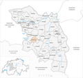
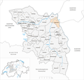
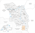
 Karte Gemeinde Auswil 2020.png 1,476 × 1,402; 520 KB
-
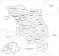
 Karte Gemeinde Bannwil 2020.png 1,476 × 1,402; 520 KB
-
 Karte Gemeinde Berken 2020.png 1,476 × 1,402; 520 KB
-
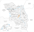
 Karte Gemeinde Bettenhausen 2020.png 1,476 × 1,402; 520 KB
-
 Karte Gemeinde Bleienbach 2020.png 1,476 × 1,402; 521 KB
-
 Karte Gemeinde Busswil bei Melchnau 2020.png 1,476 × 1,402; 520 KB
-
 Karte Gemeinde Eriswil 2020.png 1,476 × 1,402; 520 KB
-
 Karte Gemeinde Farnern 2020.png 1,476 × 1,402; 520 KB
-
 Karte Gemeinde Gondiswil 2020.png 1,476 × 1,402; 521 KB
-
 Karte Gemeinde Graben 2020.png 1,476 × 1,402; 520 KB
-
 Karte Gemeinde Heimenhausen 2020.png 1,476 × 1,402; 520 KB
-
 Karte Gemeinde Herzogenbuchsee 2020.png 1,476 × 1,402; 521 KB
-
 Karte Gemeinde Huttwil 2020.png 1,476 × 1,402; 521 KB
-
 Karte Gemeinde Inkwil 2020.png 1,476 × 1,402; 520 KB
-
 Karte Gemeinde Langenthal 2020.png 1,476 × 1,402; 521 KB
-
 Karte Gemeinde Lotzwil 2020.png 1,476 × 1,402; 521 KB
-
 Karte Gemeinde Madiswil 2020.png 1,476 × 1,402; 521 KB
-
 Karte Gemeinde Melchnau 2020.png 1,476 × 1,402; 520 KB
-
 Karte Gemeinde Niederbipp 2020.png 1,476 × 1,402; 521 KB
-
 Karte Gemeinde Niederönz 2020.png 1,476 × 1,402; 520 KB
-
 Karte Gemeinde Oberbipp 2020.png 1,476 × 1,402; 521 KB
-
 Karte Gemeinde Obersteckholz 2020.png 1,476 × 1,402; 520 KB
-
 Karte Gemeinde Ochlenberg 2020.png 1,476 × 1,402; 521 KB
-
 Karte Gemeinde Oeschenbach 2020.png 1,476 × 1,402; 520 KB
-
 Karte Gemeinde Reisiswil 2020.png 1,476 × 1,402; 520 KB
-
 Karte Gemeinde Roggwil 2020.png 1,476 × 1,402; 521 KB
-
 Karte Gemeinde Rohrbach 2020.png 1,476 × 1,402; 521 KB
-
 Karte Gemeinde Rohrbachgraben 2020.png 1,476 × 1,402; 520 KB
-
 Karte Gemeinde Rumisberg 2020.png 1,476 × 1,402; 521 KB
-
 Karte Gemeinde Rütschelen 2020.png 1,476 × 1,402; 520 KB
-
 Karte Gemeinde Schwarzhäusern 2020.png 1,476 × 1,402; 520 KB
-
 Karte Gemeinde Seeberg 2020.png 1,476 × 1,402; 521 KB
-
 Karte Gemeinde Thunstetten 2020.png 1,476 × 1,402; 521 KB
-
 Karte Gemeinde Thörigen 2020.png 1,476 × 1,402; 521 KB
-
 Karte Gemeinde Ursenbach 2020.png 1,476 × 1,402; 521 KB
-
 Karte Gemeinde Walliswil bei Niederbipp 2020.png 1,476 × 1,402; 520 KB
-
 Karte Gemeinde Walliswil bei Wangen 2020.png 1,476 × 1,402; 520 KB
-
 Karte Gemeinde Walterswil 2020.png 1,476 × 1,402; 521 KB
-
 Karte Gemeinde Wangen an der Aare 2020.png 1,476 × 1,402; 521 KB
-
 Karte Gemeinde Wangenried 2020.png 1,476 × 1,402; 520 KB
-
 Karte Gemeinde Wiedlisbach 2020.png 1,476 × 1,402; 521 KB
-
 Karte Gemeinde Wynau 2020.png 1,476 × 1,402; 520 KB
-
 Karte Gemeinde Wyssachen 2020.png 1,476 × 1,402; 521 KB


