Category:Maps of municipalities in the district of Nyon to 2014
Jump to navigation
Jump to search
Media in category "Maps of municipalities in the district of Nyon to 2014"
The following 48 files are in this category, out of 48 total.
-
 Karte Gemeinden des Bezirks Nyon 2008.png 1,476 × 1,389; 591 KB
-
 Karte Gemeinde Arnex-sur-Nyon 2008.png 1,476 × 1,389; 591 KB
-
 Karte Gemeinde Arzier 2008.png 1,476 × 1,389; 594 KB
-
 Karte Gemeinde Bassins 2008.png 1,476 × 1,389; 593 KB
-
 Karte Gemeinde Begnins 2008.png 1,476 × 1,389; 592 KB
-
 Karte Gemeinde Bogis-Bossey 2008.png 1,476 × 1,389; 591 KB
-
 Karte Gemeinde Borex 2008.png 1,476 × 1,389; 592 KB
-
 Karte Gemeinde Bursinel 2008.png 1,476 × 1,389; 591 KB
-
 Karte Gemeinde Bursins 2008.png 1,476 × 1,389; 592 KB
-
 Karte Gemeinde Burtigny 2008.png 1,476 × 1,389; 592 KB
-
 Karte Gemeinde Chavannes-de-Bogis 2008.png 1,476 × 1,389; 591 KB
-
 Karte Gemeinde Chavannes-des-Bois 2008.png 1,476 × 1,389; 591 KB
-
 Karte Gemeinde Chéserex 2008.png 1,476 × 1,389; 593 KB
-
 Karte Gemeinde Coinsins 2008.png 1,476 × 1,389; 592 KB
-
 Karte Gemeinde Commugny 2008.png 1,476 × 1,389; 592 KB
-
 Karte Gemeinde Coppet 2008.png 1,476 × 1,389; 591 KB
-
 Karte Gemeinde Crans-près-Céligny 2008.png 1,476 × 1,389; 591 KB
-
 Karte Gemeinde Crassier 2008.png 1,476 × 1,389; 592 KB
-
 Karte Gemeinde Duillier 2008.png 1,476 × 1,389; 592 KB
-
 Karte Gemeinde Dully 2008.png 1,476 × 1,389; 592 KB
-
 Karte Gemeinde Essertines-sur-Rolle 2008.png 1,476 × 1,389; 592 KB
-
 Karte Gemeinde Eysins 2008.png 1,476 × 1,389; 592 KB
-
 Karte Gemeinde Founex 2008.png 1,476 × 1,389; 592 KB
-
 Karte Gemeinde Genolier 2008.png 1,476 × 1,389; 592 KB
-
 Karte Gemeinde Gilly 2008.png 1,476 × 1,389; 592 KB
-
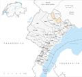
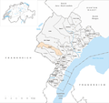 Karte Gemeinde Gingins 2008.png 1,476 × 1,389; 593 KB
-
 Karte Gemeinde Givrins 2008.png 1,476 × 1,389; 592 KB
-
 Karte Gemeinde Gland 2008.png 1,476 × 1,389; 592 KB
-
 Karte Gemeinde Grens 2008.png 1,476 × 1,389; 592 KB
-
 Karte Gemeinde La Rippe 2008.png 1,476 × 1,389; 593 KB
-
 Karte Gemeinde Le Vaud 2008.png 1,476 × 1,389; 592 KB
-
 Karte Gemeinde Longirod 2008.png 1,476 × 1,389; 593 KB
-
 Karte Gemeinde Luins 2008.png 1,476 × 1,389; 592 KB
-
 Karte Gemeinde Marchissy 2008.png 1,476 × 1,389; 592 KB
-
 Karte Gemeinde Mies 2008.png 1,476 × 1,389; 592 KB
-
 Karte Gemeinde Mont-sur-Rolle 2008.png 1,476 × 1,389; 592 KB
-
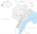
 Karte Gemeinde Nyon 2008.png 1,476 × 1,389; 592 KB
-
 Karte Gemeinde Perroy 2008.png 1,476 × 1,389; 592 KB
-
 Karte Gemeinde Prangins 2008.png 1,476 × 1,389; 592 KB
-
 Karte Gemeinde Rolle 2008.png 1,476 × 1,389; 592 KB
-
 Karte Gemeinde Saint-Cergue 2008.png 1,476 × 1,389; 594 KB
-
 Karte Gemeinde Saint-George 2008.png 1,476 × 1,389; 592 KB
-
 Karte Gemeinde Signy-Avenex 2008.png 1,476 × 1,389; 592 KB
-
 Karte Gemeinde Tannay 2008.png 1,476 × 1,389; 592 KB
-
 Karte Gemeinde Tartegnin 2008.png 1,476 × 1,389; 592 KB
-
 Karte Gemeinde Trélex 2008.png 1,476 × 1,389; 592 KB
-
 Karte Gemeinde Vich 2008.png 1,476 × 1,389; 592 KB
-
 Karte Gemeinde Vinzel 2008.png 1,476 × 1,389; 592 KB


