Category:Maps of municipalities in the district of Moësa to 2014
Jump to navigation
Jump to search
Media in category "Maps of municipalities in the district of Moësa to 2014"
The following 18 files are in this category, out of 18 total.
-
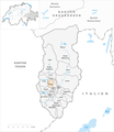
 Karte Gemeinden des Bezirks Moësa 2009.png 1,476 × 1,696; 538 KB
-
 Karte Gemeinde Arvigo 2009.png 1,476 × 1,696; 539 KB
-
 Karte Gemeinde Braggio 2009.png 1,476 × 1,696; 538 KB
-
 Karte Gemeinde Buseno 2009.png 1,476 × 1,696; 539 KB
-
 Karte Gemeinde Cama 2009.png 1,476 × 1,696; 539 KB
-
 Karte Gemeinde Castaneda 2009.png 1,476 × 1,696; 538 KB
-
 Karte Gemeinde Cauco 2009.png 1,476 × 1,696; 539 KB
-
 Karte Gemeinde Grono 2009.png 1,476 × 1,696; 539 KB
-
 Karte Gemeinde Leggia 2009.png 1,476 × 1,696; 539 KB
-
 Karte Gemeinde Lostallo 2009.png 1,476 × 1,696; 540 KB
-
 Karte Gemeinde Mesocco 2009.png 1,476 × 1,696; 540 KB
-
 Karte Gemeinde Rossa 2009.png 1,476 × 1,696; 539 KB
-
 Karte Gemeinde Roveredo 2009.png 1,476 × 1,696; 539 KB
-
 Karte Gemeinde San Vittore 2009.png 1,476 × 1,696; 539 KB
-
 Karte Gemeinde Santa Maria in Calanca 2009.png 1,476 × 1,696; 539 KB
-
 Karte Gemeinde Selma 2009.png 1,476 × 1,696; 538 KB
-
 Karte Gemeinde Soazza 2009.png 1,476 × 1,696; 539 KB
-
 Karte Gemeinde Verdabbio 2009.png 1,476 × 1,696; 539 KB


