Category:Maps of municipalities in the district of Meilen old
Jump to navigation
Jump to search
Media in category "Maps of municipalities in the district of Meilen old"
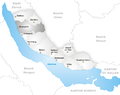
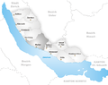
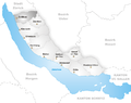
The following 11 files are in this category, out of 11 total.
-
 Karte Gemeinde Erlenbach.png 1,003 × 794; 156 KB
-
 Karte Gemeinde Herrliberg.png 1,003 × 794; 158 KB
-
 Karte Gemeinde Hombrechtikon.png 1,003 × 794; 159 KB
-
 Karte Gemeinde Küsnacht.png 1,003 × 794; 159 KB
-
 Karte Gemeinde Meilen.png 1,003 × 794; 158 KB
-
 Karte Gemeinde Männedorf.png 1,003 × 794; 157 KB
-
 Karte Gemeinde Oetwil am See.png 1,003 × 794; 157 KB
-
 Karte Gemeinde Stäfa.png 1,003 × 794; 158 KB
-
 Karte Gemeinde Uetikon am See.png 1,003 × 794; 157 KB
-
 Karte Gemeinde Zollikon.png 1,003 × 794; 158 KB
-
 Karte Gemeinde Zumikon.png 1,003 × 794; 158 KB


