Category:Maps of municipalities in the district of Lugano to 2013
Jump to navigation
Jump to search
Media in category "Maps of municipalities in the district of Lugano to 2013"
The following 61 files are in this category, out of 61 total.
-
 Karte Gemeinden des Bezirks Luganos 2012.png 1,476 × 1,488; 745 KB
-
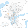
 Karte Gemeinde Agno 2012.png 1,476 × 1,488; 746 KB
-
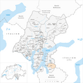
 Karte Gemeinde Alto Malcantone 2012.png 1,476 × 1,488; 747 KB
-
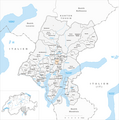
 Karte Gemeinde Aranno 2012.png 1,476 × 1,488; 746 KB
-
 Karte Gemeinde Arogno 2012.png 1,476 × 1,488; 746 KB
-
 Karte Gemeinde Astano 2012.png 1,476 × 1,488; 746 KB
-
 Karte Gemeinde Bedano 2012.png 1,476 × 1,488; 745 KB
-
 Karte Gemeinde Bedigliora 2012.png 1,476 × 1,488; 746 KB
-
 Karte Gemeinde Bioggio 2012.png 1,476 × 1,488; 747 KB
-
 Karte Gemeinde Bissone 2012.png 1,476 × 1,488; 745 KB
-
 Karte Gemeinde Bogno 2012.png 1,476 × 1,488; 746 KB
-
 Karte Gemeinde Brusino Arsizio 2012.png 1,476 × 1,488; 745 KB
-
 Karte Gemeinde Cademario 2012.png 1,476 × 1,488; 746 KB
-
 Karte Gemeinde Cadempino 2012.png 1,476 × 1,488; 745 KB
-
 Karte Gemeinde Cadro 2012.png 1,476 × 1,488; 746 KB
-
 Karte Gemeinde Canobbio 2012.png 1,476 × 1,488; 745 KB
-
 Karte Gemeinde Capriasca 2012.png 1,476 × 1,488; 747 KB
-
 Karte Gemeinde Carona 2012.png 1,476 × 1,488; 746 KB
-
 Karte Gemeinde Caslano 2012.png 1,476 × 1,488; 745 KB
-
 Karte Gemeinde Certara 2012.png 1,476 × 1,488; 746 KB
-
 Karte Gemeinde Cimadera 2012.png 1,476 × 1,488; 746 KB
-
 Karte Gemeinde Collina d'Oro 2012.png 1,476 × 1,488; 746 KB
-
 Karte Gemeinde Comano 2012.png 1,476 × 1,488; 745 KB
-
 Karte Gemeinde Croglio 2012.png 1,476 × 1,488; 746 KB
-
 Karte Gemeinde Cureglia 2012.png 1,476 × 1,488; 745 KB
-
 Karte Gemeinde Curio 2012.png 1,476 × 1,488; 746 KB
-
 Karte Gemeinde Grancia 2012.png 1,476 × 1,488; 745 KB
-
 Karte Gemeinde Gravesano 2012.png 1,476 × 1,488; 745 KB
-
 Karte Gemeinde Kommunanz Capriasca Valcolla 2012.png 1,476 × 1,488; 745 KB
-
 Karte Gemeinde Lamone 2012.png 1,476 × 1,488; 745 KB
-
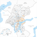 Karte Gemeinde Lugano 2012.png 1,476 × 1,488; 749 KB
-
 Karte Gemeinde Magliaso 2012.png 1,476 × 1,488; 745 KB
-
 Karte Gemeinde Manno 2012.png 1,476 × 1,488; 746 KB
-
 Karte Gemeinde Maroggia 2012.png 1,476 × 1,488; 745 KB
-
 Karte Gemeinde Massagno 2012.png 1,476 × 1,488; 745 KB
-
 Karte Gemeinde Melano 2012.png 1,476 × 1,488; 745 KB
-
 Karte Gemeinde Melide 2012.png 1,476 × 1,488; 745 KB
-
 Karte Gemeinde Mezzovico-Vira 2012.png 1,476 × 1,488; 746 KB
-
 Karte Gemeinde Miglieglia 2012.png 1,476 × 1,488; 746 KB
-
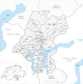
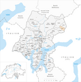
 Karte Gemeinde Monteceneri 2012.png 1,476 × 1,488; 747 KB
-
 Karte Gemeinde Monteggio 2012.png 1,476 × 1,488; 746 KB
-
 Karte Gemeinde Morcote 2012.png 1,476 × 1,488; 745 KB
-
 Karte Gemeinde Muzzano 2012.png 1,476 × 1,488; 745 KB
-
 Karte Gemeinde Neggio 2012.png 1,476 × 1,488; 745 KB
-
 Karte Gemeinde Novaggio 2012.png 1,476 × 1,488; 746 KB
-
 Karte Gemeinde Origlio 2012.png 1,476 × 1,488; 746 KB
-
 Karte Gemeinde Paradiso 2012.png 1,476 × 1,488; 745 KB
-
 Karte Gemeinde Ponte Capriasca 2012.png 1,476 × 1,488; 746 KB
-
 Karte Gemeinde Ponte Tresa 2012.png 1,476 × 1,488; 745 KB
-
 Karte Gemeinde Porza 2012.png 1,476 × 1,488; 746 KB
-
 Karte Gemeinde Pura 2012.png 1,476 × 1,488; 746 KB
-
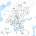
 Karte Gemeinde Rovio 2012.png 1,476 × 1,488; 509 KB
-
 Karte Gemeinde Savosa 2012.png 1,476 × 1,488; 745 KB
-
 Karte Gemeinde Sessa 2012.png 1,476 × 1,488; 746 KB
-
 Karte Gemeinde Sonvico 2012.png 1,476 × 1,488; 746 KB
-
 Karte Gemeinde Sorengo 2012.png 1,476 × 1,488; 745 KB
-
 Karte Gemeinde Torricella-Taverne 2012.png 1,476 × 1,488; 746 KB
-
 Karte Gemeinde Valcolla 2012.png 1,476 × 1,488; 746 KB
-
 Karte Gemeinde Vernate 2012.png 1,476 × 1,488; 745 KB
-
 Karte Gemeinde Vezia 2012.png 1,476 × 1,488; 745 KB
-
 Karte Gemeinde Vico Morcote 2012.png 1,476 × 1,488; 745 KB


