Category:Maps of municipalities in the district of Landquart to 2011
Jump to navigation
Jump to search
Media in category "Maps of municipalities in the district of Landquart to 2011"
The following 11 files are in this category, out of 11 total.
-
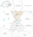
 Karte Gemeinden des Bezirks Landquart 2009.png 1,476 × 1,654; 496 KB
-
 Karte Gemeinde Fläsch 2009.png 1,476 × 1,654; 498 KB
-
 Karte Gemeinde Haldenstein 2009.png 1,476 × 1,654; 497 KB
-
 Karte Gemeinde Igis 2009.png 1,476 × 1,654; 497 KB
-
 Karte Gemeinde Jenins 2009.png 1,476 × 1,654; 498 KB
-
 Karte Gemeinde Maienfeld 2009.png 1,476 × 1,654; 499 KB
-
 Karte Gemeinde Malans 2009.png 1,476 × 1,654; 497 KB
-
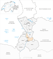
 Karte Gemeinde Mastrils 2009.png 1,476 × 1,654; 497 KB
-
 Karte Gemeinde Trimmis 2009.png 1,476 × 1,654; 498 KB
-
 Karte Gemeinde Untervaz 2009.png 1,476 × 1,654; 497 KB
-
 Karte Gemeinde Zizers 2009.png 1,476 × 1,654; 497 KB


