Category:Maps of municipalities in the district of Brugg to 2013
Jump to navigation
Jump to search
Media in category "Maps of municipalities in the district of Brugg to 2013"
The following 27 files are in this category, out of 27 total.
-
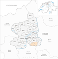
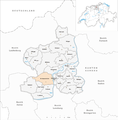
 Karte Gemeinden des Bezirks Brugg 2013.png 1,476 × 1,500; 543 KB
-
 Karte Gemeinde Auenstein 2013.png 1,476 × 1,500; 544 KB
-
 Karte Gemeinde Birr 2013.png 1,476 × 1,500; 544 KB
-
 Karte Gemeinde Birrhard 2013.png 1,476 × 1,500; 544 KB
-
 Karte Gemeinde Brugg 2013.png 1,476 × 1,500; 545 KB
-
 Karte Gemeinde Bözberg 2013.png 1,476 × 1,500; 545 KB
-
 Karte Gemeinde Bözen 2013.png 1,476 × 1,500; 544 KB
-
 Karte Gemeinde Effingen 2013.png 1,476 × 1,500; 545 KB
-
 Karte Gemeinde Elfingen 2013.png 1,476 × 1,500; 544 KB
-
 Karte Gemeinde Habsburg 2013.png 1,476 × 1,500; 544 KB
-
 Karte Gemeinde Hausen AG 2013.png 1,476 × 1,500; 544 KB
-
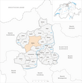
 Karte Gemeinde Lupfig 2013.png 1,476 × 1,500; 544 KB
-
 Karte Gemeinde Mandach 2013.png 1,476 × 1,500; 543 KB
-
 Karte Gemeinde Mönthal 2013.png 1,476 × 1,500; 544 KB
-
 Karte Gemeinde Mülligen 2013.png 1,476 × 1,500; 544 KB
-
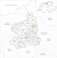
 Karte Gemeinde Oberflachs 2013.png 1,476 × 1,500; 544 KB
-
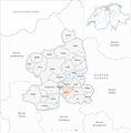
 Karte Gemeinde Remigen 2013.png 1,476 × 1,500; 544 KB
-
 Karte Gemeinde Riniken 2013.png 1,476 × 1,500; 544 KB
-
 Karte Gemeinde Rüfenach 2013.png 1,476 × 1,500; 544 KB
-
 Karte Gemeinde Scherz 2013.png 1,476 × 1,500; 544 KB
-
 Karte Gemeinde Schinznach-Bad 2013.png 1,476 × 1,500; 544 KB
-
 Karte Gemeinde Schinznach-Dorf 2013.png 1,476 × 1,500; 544 KB
-
 Karte Gemeinde Thalheim AG 2013.png 1,476 × 1,500; 544 KB
-
 Karte Gemeinde Veltheim 2013.png 1,476 × 1,500; 544 KB
-
 Karte Gemeinde Villigen 2013.png 1,476 × 1,500; 544 KB
-
 Karte Gemeinde Villnachern 2013.png 1,476 × 1,500; 544 KB
-
 Karte Gemeinde Windisch 2013.png 1,476 × 1,500; 544 KB


