Category:Maps of municipalities in the district of Broye-Vully to 2021
Jump to navigation
Jump to search
Media in category "Maps of municipalities in the district of Broye-Vully to 2021"
The following 64 files are in this category, out of 64 total.
-
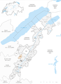
 Carte communes du district de la Broye-Vully 2017.png 1,771 × 2,438; 767 KB
-
 Karte Gemeinden des Bezirks Broye-Vully 2017.png 1,771 × 2,438; 703 KB
-
 Carte commune Avenches 2017.png 1,771 × 2,438; 759 KB
-
 Karte Gemeinde Avenches 2017.png 1,771 × 2,438; 704 KB
-
 Carte commune Bussy-sur-Moudon 2017.png 1,771 × 2,438; 759 KB
-
 Karte Gemeinde Bussy-sur-Moudon 2017.png 1,771 × 2,438; 703 KB
-
 Carte commune Champtauroz 2017.png 1,771 × 2,438; 759 KB
-
 Karte Gemeinde Champtauroz 2017.png 1,771 × 2,438; 703 KB
-
 Carte commune Chavannes-sur-Moudon 2017.png 1,771 × 2,438; 759 KB
-
 Karte Gemeinde Chavannes-sur-Moudon 2017.png 1,771 × 2,438; 703 KB
-
 Carte commune Chevroux 2017.png 1,771 × 2,438; 759 KB
-
 Karte Gemeinde Chevroux 2017.png 1,771 × 2,438; 703 KB
-
 Carte commune Corcelles-le-Jorat 2017.png 1,771 × 2,438; 759 KB
-
 Karte Gemeinde Corcelles-le-Jorat 2017.png 1,771 × 2,438; 703 KB
-
 Carte commune Corcelles-près-Payerne 2017.png 1,771 × 2,438; 759 KB
-
 Karte Gemeinde Corcelles-près-Payerne 2017.png 1,771 × 2,438; 703 KB
-
 Carte commune Cudrefin 2017.png 1,771 × 2,438; 759 KB
-
 Karte Gemeinde Cudrefin 2017.png 1,771 × 2,438; 703 KB
-
 Carte commune Curtilles 2017.png 1,771 × 2,438; 759 KB
-
 Karte Gemeinde Curtilles 2017.png 1,771 × 2,438; 704 KB
-
 Carte commune Dompierre 2017.png 1,771 × 2,438; 759 KB
-
 Karte Gemeinde Dompierre 2017.png 1,771 × 2,438; 703 KB
-
 Carte commune Faoug 2017.png 1,771 × 2,438; 759 KB
-
 Karte Gemeinde Faoug 2017.png 1,771 × 2,438; 703 KB
-
 Carte commune Grandcour 2017.png 1,771 × 2,438; 759 KB
-
 Karte Gemeinde Grandcour 2017.png 1,771 × 2,438; 704 KB
-
 Carte commune Henniez 2017.png 1,771 × 2,438; 759 KB
-
 Karte Gemeinde Henniez 2017.png 1,771 × 2,438; 703 KB
-
 Carte commune Hermenches 2017.png 1,771 × 2,438; 759 KB
-
 Karte Gemeinde Hermenches 2017.png 1,771 × 2,438; 703 KB
-
 Carte commune Lovatens 2017.png 1,771 × 2,438; 759 KB
-
 Karte Gemeinde Lovatens 2017.png 1,771 × 2,438; 703 KB
-
 Carte commune Lucens 2017.png 1,771 × 2,438; 768 KB
-
 Karte Gemeinde Lucens 2017.png 1,771 × 2,438; 704 KB
-
 Carte commune Missy 2017.png 1,771 × 2,438; 759 KB
-
 Karte Gemeinde Missy 2017.png 1,771 × 2,438; 703 KB
-
 Carte commune Moudon 2017.png 1,771 × 2,438; 760 KB
-
 Karte Gemeinde Moudon 2017.png 1,771 × 2,438; 704 KB
-
 Carte commune Payerne 2017.png 1,771 × 2,438; 760 KB
-
 Karte Gemeinde Payerne 2017.png 1,771 × 2,438; 704 KB
-
 Carte commune Prévonloup 2017.png 1,771 × 2,438; 759 KB
-
 Karte Gemeinde Prévonloup 2017.png 1,771 × 2,438; 703 KB
-
 Carte commune Ropraz 2017.png 1,771 × 2,438; 759 KB
-
 Karte Gemeinde Ropraz 2017.png 1,771 × 2,438; 703 KB
-
 Carte commune Rossenges 2017.png 1,771 × 2,438; 759 KB
-
 Karte Gemeinde Rossenges 2017.png 1,771 × 2,438; 703 KB
-
 Carte commune Syens 2017.png 1,771 × 2,438; 759 KB
-
 Karte Gemeinde Syens 2017.png 1,771 × 2,438; 703 KB
-
 Carte commune Trey 2017.png 1,771 × 2,438; 759 KB
-
 Karte Gemeinde Trey 2017.png 1,771 × 2,438; 703 KB
-
 Karte Gemeinde Treytorrens (Payerne) 2017.png 1,771 × 2,438; 703 KB
-
 Carte commune Treytorrens (Payerne) 2017.png 1,771 × 2,438; 759 KB
-
 Carte commune Valbroye 2017.png 1,771 × 2,438; 760 KB
-
 Karte Gemeinde Valbroye 2017.png 1,771 × 2,438; 705 KB
-
 Carte commune Villars-le-Comte 2017.png 1,771 × 2,438; 760 KB
-
 Karte Gemeinde Villars-le-Comte 2017.png 1,771 × 2,438; 704 KB
-
 Carte commune Villarzel 2017.png 1,771 × 2,438; 760 KB
-
 Karte Gemeinde Villarzel 2017.png 1,771 × 2,438; 705 KB
-
 Carte commune Vucherens 2017.png 1,771 × 2,438; 760 KB
-
 Karte Gemeinde Vucherens 2017.png 1,771 × 2,438; 704 KB
-
 Carte commune Vulliens 2017.png 1,771 × 2,438; 760 KB
-
 Karte Gemeinde Vulliens 2017.png 1,771 × 2,438; 705 KB
-
 Carte commune Vully-les-Lacs 2017.png 1,771 × 2,438; 760 KB
-
 Karte Gemeinde Vully-les-Lacs 2017.png 1,771 × 2,438; 705 KB


_2017.png)
_2017.png)


