Category:Maps of municipalities in the district of Broye-Vully to 06.2016
Jump to navigation
Jump to search
Media in category "Maps of municipalities in the district of Broye-Vully to 06.2016"
The following 38 files are in this category, out of 38 total.
-
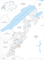
 Karte Gemeinden des Bezirks Broye-Vully 2011.png 1,771 × 2,439; 963 KB
-
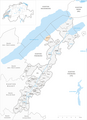
 Karte Gemeinde Avenches 2011.png 1,771 × 2,439; 964 KB
-
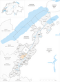
 Karte Gemeinde Brenles 2011.png 1,771 × 2,439; 964 KB
-
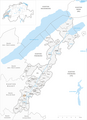
 Karte Gemeinde Bussy-sur-Moudon 2011.png 1,771 × 2,439; 964 KB
-
 Karte Gemeinde Carrouge 2011.png 1,771 × 2,439; 964 KB
-
 Karte Gemeinde Champtauroz 2011.png 1,771 × 2,439; 963 KB
-
 Karte Gemeinde Chavannes-sur-Moudon 2011.png 1,771 × 2,439; 964 KB
-
 Karte Gemeinde Chesalles-sur-Moudon 2011.png 1,771 × 2,439; 963 KB
-
 Karte Gemeinde Chevroux 2011.png 1,771 × 2,439; 963 KB
-
 Karte Gemeinde Corcelles-le-Jorat 2011.png 1,771 × 2,439; 964 KB
-
 Karte Gemeinde Corcelles-près-Payerne 2011.png 1,771 × 2,439; 964 KB
-
 Karte Gemeinde Cremin 2011.png 1,771 × 2,439; 963 KB
-
 Karte Gemeinde Cudrefin 2011.png 1,771 × 2,439; 964 KB
-
 Karte Gemeinde Curtilles 2011.png 1,771 × 2,439; 964 KB
-
 Karte Gemeinde Dompierre 2011.png 1,771 × 2,439; 964 KB
-
 Karte Gemeinde Faoug 2011.png 1,771 × 2,439; 963 KB
-
 Karte Gemeinde Forel-sur-Lucens 2011.png 1,771 × 2,439; 964 KB
-
 Karte Gemeinde Grandcour 2011.png 1,771 × 2,439; 964 KB
-
 Karte Gemeinde Henniez 2011.png 1,771 × 2,439; 963 KB
-
 Karte Gemeinde Hermenches 2011.png 1,771 × 2,439; 963 KB
-
 Karte Gemeinde Lovatens 2011.png 1,771 × 2,439; 964 KB
-
 Karte Gemeinde Lucens 2011.png 1,771 × 2,439; 964 KB
-
 Karte Gemeinde Missy 2011.png 1,771 × 2,439; 963 KB
-
 Karte Gemeinde Moudon 2011.png 1,771 × 2,439; 965 KB
-
 Karte Gemeinde Payerne 2011.png 1,771 × 2,439; 964 KB
-
 Karte Gemeinde Prévonloup 2011.png 1,771 × 2,439; 964 KB
-
 Karte Gemeinde Ropraz 2011.png 1,771 × 2,439; 964 KB
-
 Karte Gemeinde Rossenges 2011.png 1,771 × 2,439; 963 KB
-
 Karte Gemeinde Sarzens 2011.png 1,771 × 2,439; 963 KB
-
 Karte Gemeinde Syens 2011.png 1,771 × 2,439; 963 KB
-
 Karte Gemeinde Trey 2011.png 1,771 × 2,439; 964 KB
-
 Karte Gemeinde Treytorrens (Payerne) 2011.png 1,771 × 2,439; 964 KB
-
 Karte Gemeinde Valbroye 2011.png 1,771 × 2,439; 966 KB
-
 Karte Gemeinde Villars-le-Comte 2011.png 1,771 × 2,439; 964 KB
-
 Karte Gemeinde Villarzel 2011.png 1,771 × 2,439; 964 KB
-
 Karte Gemeinde Vucherens 2011.png 1,771 × 2,439; 963 KB
-
 Karte Gemeinde Vulliens 2011.png 1,771 × 2,439; 964 KB
-
 Karte Gemeinde Vully-les-Lacs 2011.png 1,771 × 2,439; 964 KB


_2011.png)


