Category:Maps of municipalities in the district of Boudry to 2017
Jump to navigation
Jump to search
Media in category "Maps of municipalities in the district of Boudry to 2017"
The following 13 files are in this category, out of 13 total.
-
 Karte Gemeinden des Bezirks Boudry 2016.png 1,476 × 1,294; 464 KB
-
 Karte Gemeinde Bevaix 2016.png 1,476 × 1,294; 466 KB
-
 Karte Gemeinde Boudry 2016.png 1,476 × 1,294; 466 KB
-
 Karte Gemeinde Corcelles-Cormondrèche 2016.png 1,476 × 1,294; 465 KB
-
 Karte Gemeinde Cortaillod 2016.png 1,476 × 1,294; 465 KB
-
 Karte Gemeinde Fresens 2016.png 1,476 × 1,294; 465 KB
-
 Karte Gemeinde Gorgier 2016.png 1,476 × 1,294; 466 KB
-
 Karte Gemeinde Milvignes 2016.png 1,476 × 1,294; 465 KB
-
 Karte Gemeinde Montalchez 2016.png 1,476 × 1,294; 465 KB
-
 Karte Gemeinde Peseux 2016.png 1,476 × 1,294; 465 KB
-
 Karte Gemeinde Rochefort 2016.png 1,476 × 1,294; 466 KB
-
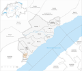
 Karte Gemeinde Saint-Aubin-Sauges 2016.png 1,476 × 1,294; 466 KB
-
 Karte Gemeinde Vaumarcus 2016.png 1,476 × 1,294; 465 KB


