Category:Maps of municipalities in the district of Baden
Jump to navigation
Jump to search
Subcategories
This category has the following 8 subcategories, out of 8 total.
1
2
Media in category "Maps of municipalities in the district of Baden"
The following 26 files are in this category, out of 26 total.
-
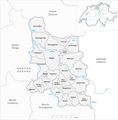 Karte Gemeinden des Bezirks Baden 2024.png 1,476 × 1,498; 455 KB
-
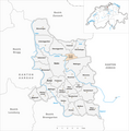
 Karte Gemeinde Baden 2024.png 1,476 × 1,498; 456 KB
-
 Karte Gemeinde Bellikon 2024.png 1,476 × 1,498; 455 KB
-
 Karte Gemeinde Bergdietikon 2024.png 1,476 × 1,498; 455 KB
-
 Karte Gemeinde Birmenstorf 2024.png 1,476 × 1,498; 455 KB
-
 Karte Gemeinde Ehrendingen 2024.png 1,476 × 1,498; 455 KB
-
 Karte Gemeinde Ennetbaden 2024.png 1,476 × 1,498; 455 KB
-
 Karte Gemeinde Fislisbach 2024.png 1,476 × 1,498; 456 KB
-
 Karte Gemeinde Freienwil 2024.png 1,476 × 1,498; 455 KB
-
 Karte Gemeinde Gebenstorf 2024.png 1,476 × 1,498; 455 KB
-
 Karte Gemeinde Killwangen 2024.png 1,476 × 1,498; 455 KB
-
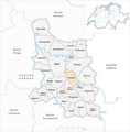
 Karte Gemeinde Künten 2024.png 1,476 × 1,498; 455 KB
-
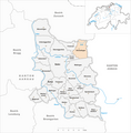
 Karte Gemeinde Mellingen 2024.png 1,476 × 1,498; 456 KB
-
 Karte Gemeinde Mägenwil 2024.png 1,476 × 1,498; 455 KB
-
 Karte Gemeinde Neuenhof 2024.png 1,476 × 1,498; 456 KB
-
 Karte Gemeinde Niederrohrdorf 2024.png 1,476 × 1,498; 456 KB
-
 Karte Gemeinde Oberrohrdorf 2024.png 1,476 × 1,498; 456 KB
-
 Karte Gemeinde Obersiggenthal 2024.png 1,476 × 1,498; 455 KB
-
 Karte Gemeinde Remetschwil 2024.png 1,476 × 1,498; 455 KB
-
 Karte Gemeinde Spreitenbach 2024.png 1,476 × 1,498; 456 KB
-
 Karte Gemeinde Stetten AG 2024.png 1,476 × 1,498; 455 KB
-
 Karte Gemeinde Untersiggenthal 2024.png 1,476 × 1,498; 455 KB
-
 Karte Gemeinde Wettingen 2024.png 1,476 × 1,498; 455 KB
-
 Karte Gemeinde Wohlenschwil 2024.png 1,476 × 1,498; 456 KB
-
 Karte Gemeinde Würenlingen 2024.png 1,476 × 1,498; 455 KB
-
 Karte Gemeinde Würenlos 2024.png 1,476 × 1,498; 455 KB


