Category:Maps of municipalities in the district of Arbon
Jump to navigation
Jump to search
Subcategories
This category has the following 5 subcategories, out of 5 total.
1
Media in category "Maps of municipalities in the district of Arbon"
The following 13 files are in this category, out of 13 total.
-
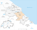
 Karte Gemeinden des Bezirks Arbon 2011.png 1,476 × 1,217; 430 KB
-
 Karte Gemeinde Amriswil 2011.png 1,476 × 1,217; 432 KB
-
 Karte Gemeinde Arbon 2011.png 1,476 × 1,217; 431 KB
-
 Karte Gemeinde Dozwil 2011.png 1,476 × 1,217; 431 KB
-
 Karte Gemeinde Egnach 2011.png 1,476 × 1,217; 432 KB
-
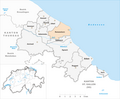
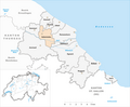 Karte Gemeinde Hefenhofen 2011.png 1,476 × 1,217; 431 KB
-
 Karte Gemeinde Horn 2011.png 1,476 × 1,217; 431 KB
-
 Karte Gemeinde Kesswil 2011.png 1,476 × 1,217; 431 KB
-
 Karte Gemeinde Roggwil TG 2011.png 1,476 × 1,217; 432 KB
-
 Karte Gemeinde Romanshorn 2011.png 1,476 × 1,217; 431 KB
-
 Karte Gemeinde Salmsach 2011.png 1,476 × 1,217; 431 KB
-
 Karte Gemeinde Sommeri 2011.png 1,476 × 1,217; 431 KB
-
 Karte Gemeinde Uttwil 2011.png 1,476 × 1,217; 431 KB


