Category:Maps of municipalities in the canton of Valais to 2016
Jump to navigation
Jump to search
Media in category "Maps of municipalities in the canton of Valais to 2016"
The following 8 files are in this category, out of 8 total.
-
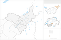 Karte Bezirk Goms 2009 blank.png 2,066 × 1,358; 520 KB
-
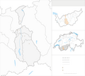
 Karte Bezirk Goms 2009.png 2,066 × 1,357; 695 KB
-
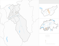
 Karte Bezirk Hérens 2011 blank.png 1,771 × 1,596; 528 KB
-
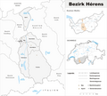 Karte Bezirk Hérens 2011.png 2,066 × 1,861; 816 KB
-
 Karte Bezirk Sierre 2009 blank.png 2,066 × 1,613; 605 KB
-
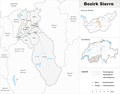 Karte Bezirk Sierre 2009.png 2,066 × 1,613; 755 KB
-
 Karte Bezirk Sion 2013 blank.png 2,066 × 1,386; 456 KB
-
 Karte Bezirk Sion 2013.png 2,066 × 1,386; 584 KB


