Category:Maps of municipalities in the canton of Solothurn to 2010
Jump to navigation
Jump to search
Media in category "Maps of municipalities in the canton of Solothurn to 2010"
The following 3 files are in this category, out of 3 total.
-
 Karte Unterleberberg.png 800 × 450; 147 KB
-
 Karte Bezirk Lebern 2007 blank.png 1,771 × 997; 315 KB
-
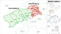
 Karte Bezirk Lebern 2007.png 1,771 × 997; 383 KB

