Category:Maps of municipalities in the canton of Neuchâtel Fusion 1875
Jump to navigation
Jump to search
Media in category "Maps of municipalities in the canton of Neuchâtel Fusion 1875"
The following 4 files are in this category, out of 4 total.
-
 Karte Bezirk Boudry Gemeindeveraenderungen 1875.png 1,476 × 1,294; 373 KB
-
 Karte Bezirk Le Locle Gemeindeveraenderungen 1875.png 1,475 × 1,090; 275 KB
-
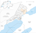 Karte Bezirk Neuchâtel Gemeindeveraenderungen 1875.png 1,476 × 1,369; 452 KB
-
 Karte Bezirk Val-de-Ruz Gemeindeveraenderungen 1875.png 1,476 × 1,305; 411 KB


