Category:Maps of mountains of Lauda-Königshofen
Jump to navigation
Jump to search
Deutsch: Lagekarten (oder Kartenausschnitte) von Bergen in Lauda-Königshofen
Media in category "Maps of mountains of Lauda-Königshofen"
The following 3 files are in this category, out of 3 total.
-
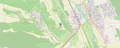 Lage Frauenberg bei Lauda-Königshofen.png 1,859 × 749; 1.18 MB
-
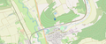 Lage Gerlachsheimer Herrenberg.png 1,860 × 774; 960 KB
-
 Lage Kehlberg (Gerlachsheim).png 1,857 × 782; 867 KB

.png)