Category:Maps of mines
Jump to navigation
Jump to search
Subcategories
This category has only the following subcategory.
M
Media in category "Maps of mines"
The following 30 files are in this category, out of 30 total.
-
 10 of 'Explosions in Coal Mines. (With nine plans.)' (11126880835).jpg 4,530 × 3,269; 1.84 MB
-
 23 of 'Explosions in Coal Mines. (With nine plans.)' (11127421804).jpg 5,024 × 3,697; 2.28 MB
-
 27 of 'Explosions in Coal Mines. (With nine plans.)' (11125280806).jpg 6,112 × 4,713; 3.47 MB
-
 33 of 'Explosions in Coal Mines. (With nine plans.)' (11124264525).jpg 6,027 × 4,319; 3.19 MB
-

-
 BML Le Lointain partie 3 77 7017 Mappa Metallographica.jpg 4,676 × 3,649; 12.89 MB
-

-

-
 Gottessegen Ernsdorfer Zeche Kreuztal.png 1,150 × 910; 1.06 MB
-
 Grubenplan Stahlseifen Salchendorf 1905.jpg 600 × 851; 177 KB
-
 GrubeRosenhof.jpg 1,659 × 2,301; 1.19 MB
-
 Grundriss Gnade Gottes Stangenwage Bergmannsglück Haus Nassau.png 1,418 × 1,088; 227 KB
-

-

-
 M.S -1799.jpg 3,292 × 2,512; 3.52 MB
-

-
 Muzeum Izba Pamieci Kopalni Wujek 23.JPG 2,448 × 3,264; 3.21 MB
-
 Nasa1640.jpg 1,000 × 652; 175 KB
-
 Nasadetalj1646.jpg 892 × 737; 264 KB
-
 Nasagruvan 1646.jpg 800 × 651; 111 KB
-
 North Star Mine Cross Section.jpg 790 × 570; 156 KB
-
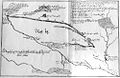
 North Star Mine Map.jpg 946 × 611; 214 KB
-
 NPS joshua-tree-old-dale-black-eagle-mine-road-map.pdf 2,118 × 3,097; 84 KB
-
 Opitonui Mining Accident (9627687378).jpg 1,739 × 1,799; 1.66 MB
-
 Pithå silfferbrukz affrijtningh Lapländisch marsch.jpg 9,815 × 7,213; 9.16 MB
-
 Ross-Adams mine diagram.PNG 1,039 × 676; 55 KB
-
 Schemnitz in Danubius Pannonico-Mysicus 1726 by Marsigli.jpg 2,651 × 1,710; 1,005 KB
-
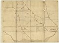
 Stonehills Map.jpg 688 × 486; 166 KB
-
 Transvaal Gold Fields.png 631 × 497; 122 KB
-
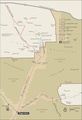
 Victor Mine and airfield in Ontario.png 1,016 × 616; 51 KB
%27_(11126880835).jpg)
%27_(11127421804).jpg)
%27_(11125280806).jpg)
%27_(11124264525).jpg)
.jpg)


_Thames_Foreshore,_1889_(Archives_reference-_BACL_A228-F55-95)_(24555396701).jpg)


.jpg)


