Category:Maps of micro tectonic plates
Jump to navigation
Jump to search
Subcategories
This category has the following 6 subcategories, out of 6 total.
Media in category "Maps of micro tectonic plates"
The following 67 files are in this category, out of 67 total.
-

-
 Adriatic Plate.jpg 817 × 783; 181 KB
-
 Balmoral Reef and Conway Reef Plates map-fr.png 585 × 331; 181 KB
-
 Banda Sea Plate map-fr.png 507 × 337; 235 KB
-
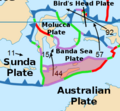
 BandaSeaPlate.png 478 × 338; 103 KB
-
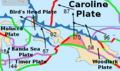
 Boxed Woodlark Basin .png 691 × 483; 180 KB
-
 Placa doberai.png 1,024 × 642; 623 KB
-
 Easter and Juan Fernandez Plates map-fr.png 639 × 338; 132 KB
-
 Easter Microplate Boundaries.png 1,882 × 898; 2.2 MB
-
 EasterPlate.png 515 × 265; 29 KB
-
 ExplorerPlate.png 508 × 630; 59 KB
-
 Futuna Plate map-fr.png 521 × 288; 151 KB
-
 Galapagos Microplate.jpg 1,201 × 893; 450 KB
-
 Galapagos Plate map-fr.png 523 × 257; 121 KB
-
 GalapagosPlate.png 397 × 262; 33 KB
-
 Gonâve microplate notext.png 2,115 × 1,337; 1.19 MB
-
 Gonâve microplate.png 2,115 × 1,337; 1.3 MB
-
 JuanFernandezPlate.png 587 × 412; 44 KB
-
 Kermadec and Tonga Plates.jpg 1,275 × 1,650; 534 KB
-
 Kermadec Plate map-fr.png 497 × 441; 150 KB
-
 Lwandle plate and its neighboring plates 3.gif 537 × 746; 34 KB
-
 Lwandle plate and its neighboring plates.gif 537 × 746; 28 KB
-
 Lwandle Plate Map.jpeg 523 × 725; 59 KB
-
 Manus Plate map-fr.png 294 × 234; 104 KB
-
 ManusPlate.png 446 × 261; 82 KB
-
 Maoke Plate map-fr.png 476 × 370; 263 KB
-
 MaokePlate.png 500 × 296; 120 KB
-
 Mariana Plate map-fr.png 528 × 274; 116 KB
-
 MarianaPlate.png 600 × 455; 62 KB
-
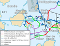 Molucca Sea Plate map-fr.png 503 × 381; 244 KB
-
 MoluccaPlate.png 474 × 342; 104 KB
-
 Niuafo'ou Plate map-fr.png 404 × 359; 164 KB
-
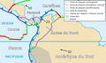
 North Andes Plate map-es.png 602 × 355; 137 KB
-
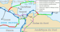
 North Andes Plate map-fr.png 642 × 379; 212 KB
-
 North Bismarck Plate map-fr.png 459 × 352; 205 KB
-
 NorthAndesPlate.png 564 × 472; 101 KB
-
 NorthBismarkPlate.png 538 × 251; 76 KB
-
 Okinawa Plate map-fr.png 498 × 278; 150 KB
-
 Okinawa Plate map-ja.png 498 × 278; 123 KB
-
 OkinawaPlate.png 454 × 283; 67 KB
-
 Panama Plate map-fr.png 628 × 342; 71 KB
-
 PanamaPlate.png 564 × 384; 94 KB
-
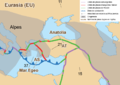 Placa de Anatolia.png 850 × 602; 220 KB
-
 Placa de Gorda.png 1,000 × 605; 432 KB
-
 Placa de Sandwich.png 1,065 × 710; 490 KB
-
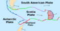
 Placa de Shetland.png 1,065 × 710; 487 KB
-
 Placa del explorador.png 999 × 710; 443 KB
-
 Placa Mar Egeo.png 805 × 625; 216 KB
-
 Plaque NouvellesHébrides &al.JPG 1,134 × 1,134; 155 KB
-
 Rivera Plate map-fr.png 498 × 301; 152 KB
-
 RiveraPlate.png 457 × 287; 52 KB
-
 Sandwich Plate map-fr.png 429 × 372; 142 KB
-
 SandwichPlate.png 922 × 482; 69 KB
-
 Shetland Plate Boundries.png 1,797 × 1,125; 2.6 MB
-
 Shetland Plate map-fr.png 556 × 295; 121 KB
-
 ShetlandPlate.png 922 × 482; 70 KB
-
 Shetlandplatte.png 922 × 482; 48 KB
-
 Solomon Sea Plate map-fr.png 435 × 260; 157 KB
-
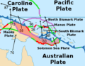
 SolomonSeaPlate.png 419 × 219; 70 KB
-
 South Bismarck Plate map-fr.png 425 × 286; 172 KB
-
 SouthBismarkPlate.png 538 × 330; 109 KB
-
 Timor Plate map-fr.png 458 × 279; 178 KB
-
 TimorPlate.png 388 × 358; 95 KB
-
 Tonga Plate map-fr.png 470 × 351; 162 KB
-
 Woodlark Plate map-fr.png 506 × 340; 224 KB
-
 WoodlarkPlate.png 562 × 434; 130 KB
-
 Yakutat Subduction.gif 502 × 411; 40 KB
.jpg)


