Category:Maps of massif du Vercors
Jump to navigation
Jump to search
Media in category "Maps of massif du Vercors"
The following 9 files are in this category, out of 9 total.
-
 DEMVercors.png 1,958 × 2,154; 1.91 MB
-
 Geogr of Vercors.jpg 2,707 × 3,535; 735 KB
-
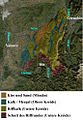 Geologie Sat Kopie.jpg 342 × 495; 194 KB
-
 Vercors geo territories roads map-fr.svg 1,350 × 1,700; 287 KB
-
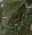 Vercors Satellit.jpg 342 × 378; 165 KB
-
 Vercors Topografie Kopie.JPG 615 × 848; 101 KB
-
 Vercors topographic map-fr.svg 1,350 × 1,700; 3.13 MB
-
 Vercors-paysages.gif 877 × 1,043; 75 KB
-
 Vercors-routes.gif 849 × 1,109; 100 KB


