Category:Maps of maritime borders
Jump to navigation
Jump to search
Subcategories
This category has the following 3 subcategories, out of 3 total.
M
T
Media in category "Maps of maritime borders"
The following 36 files are in this category, out of 36 total.
-
 A Norvég-tenger határokkal2.png 1,000 × 913; 579 KB
-
-
 Baltic Sea Borderlines 1939 german.png 1,516 × 1,178; 66 KB
-
 Blocksnethcontplat.jpg 547 × 908; 199 KB
-
 Capes of Virginia.jpg 1,872 × 3,328; 1.75 MB
-
 Caribbean maritime boundaries map zh.svg 3,561 × 2,221; 2.87 MB
-
 Caribbean maritime boundaries map.svg 3,561 × 2,221; 2.78 MB
-
 Caribbean maritime boundaries map mk.svg 3,561 × 2,221; 5.52 MB
-
 Mapa das Caraíbas (fronteiras marítimas).svg 3,561 × 2,221; 2.86 MB
-
 Mapa del Caribe (límites marinos).svg 5,340 × 3,660; 3.02 MB
-
 Mapa del Mar Caribe (límites marinos)-fr.svg 3,587 × 2,221; 1.91 MB
-
 Mapa del Mar Caribe (límites marinos).svg 3,587 × 2,221; 1.98 MB
-
 Confine marittimo Italia Spagna.png 250 × 250; 31 KB
-
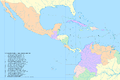
 Declaration of Panama map.png 1,674 × 1,806; 835 KB
-
 Diferendo Golfo de Venezuela.svg 1,030 × 919; 34 KB
-
 Dutch Caribbean maritime boundaries with island names.svg 1,346 × 1,156; 202 KB
-
 Dutch Caribbean maritime boundaries.svg 1,346 × 1,156; 182 KB
-
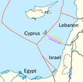 East Medit EEZs (pre-2022).png 800 × 788; 166 KB
-
 Frontières entre la France et le Vénézuela.svg 1,940 × 1,424; 1.16 MB
-
 Italy-Malta maritime border.png 173 × 243; 59 KB
-
 MAP of Angola-Benguela Front.png 3,264 × 2,448; 3.75 MB
-
 Map of Korean maritime border.svg 912 × 653; 346 KB
-
 Mapa del Caribe (límites marinos).png 2,514 × 1,667; 202 KB
-
 Mapa del Mar de Balboa (límites marinos).svg 2,177 × 2,006; 530 KB
-
 Marine boundary US - Cuba.jpg 1,038 × 1,192; 127 KB
-
 Maritime boundaries between Comoros and France-fr.svg 2,208 × 1,572; 772 KB
-
 Maritime boundaries between Seychelles and France-fr.svg 2,208 × 1,572; 770 KB
-
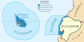 Maritime Claims of Ecuador.svg 1,364 × 686; 336 KB
-
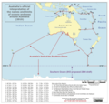
 Maritime features limits zones Australia.gif 800 × 464; 31 KB
-
 Maritime zones Australia.gif 800 × 437; 26 KB
-
 North sea eez.PNG 1,034 × 1,200; 128 KB
-
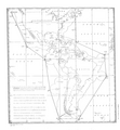
 South americanpossiblemaritimeboundaries.gif 270 × 442; 17 KB
-
 Syngman Rhee Line map.jpg 494 × 689; 199 KB
-
 Treaty signed in 1970 to resolve border along the Rio Grande, coordinates.png 1,043 × 769; 509 KB
-
 Us-su-maritime.jpg 600 × 522; 76 KB
-
 הגבול הימי של ישראל.svg 247 × 240; 1.09 MB


.svg)
.svg)
-fr.svg)
.svg)


.png)


.png)
.svg)


