Category:Maps of marine parks in France
Jump to navigation
Jump to search
Countries of Europe: France‡
Media in category "Maps of marine parks in France"
The following 14 files are in this category, out of 14 total.
-
 Carte Parc naturel marin d'Iroise.png 1,894 × 1,260; 65 KB
-
 Parcs naturels français d'outre-mer.svg 2,920 × 2,347; 526 KB
-
 Parcs naturels français de métropole.svg 2,000 × 1,930; 539 KB
-
 Parcs naturels français.svg 4,920 × 2,347; 1.12 MB
-
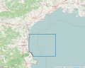
 Périmètre PNM Bassin d'Arcachon.png 1,091 × 872; 504 KB
-
 Périmètre PNM Cap Corse et Agriate.png 1,091 × 872; 384 KB
-
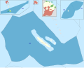
 Périmètre PNM des Glorieuses.png 1,091 × 872; 149 KB
-
 Périmètre PNM estuaire de la Gironde et mer des Pertuis.png 1,091 × 872; 814 KB
-
 Périmètre PNM estuaires picards et mer d'Opale.png 1,091 × 872; 749 KB
-
 Périmètre PNM Golfe du Lion.png 1,091 × 872; 721 KB
-
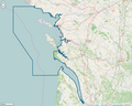
 Périmètre PNM Iroise.png 1,091 × 872; 518 KB
-
 Périmètre PNM Martinique.png 1,199 × 799; 108 KB
-
 Périmètre PNM Mayotte.png 1,091 × 872; 98 KB
-
 Périmètre Sanctuaire Agoa.png 799 × 800; 87 KB


