Category:Maps of land use in Lézignan
Jump to navigation
Jump to search
Media in category "Maps of land use in Lézignan"
The following 3 files are in this category, out of 3 total.
-
 65271-Lézignan-Orthophoto.png 7,015 × 4,960; 4.12 MB
-
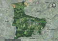
 65271-Lézignan-Sols.png 7,015 × 4,960; 3.98 MB
-
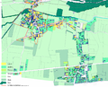 Plan cadastral de Lézignan2.png 1,949 × 1,582; 3.27 MB


